
159 Bus Route Map
View the 159 route map and see all 159 stops along the route. The map of 159 shows where the bus travels and the location of each stop, making it easy to understand the entire route at a glance.
Explore Reisedienst Bonte routes on the map and see where Reisedienst Bonte bus services operate. Use the 159 map to find bus stops and see how the 159 connects different areas along its trip.
All 159 stops on the map are displayed in route order, helping you follow the 159 bus from the first stop to the last.
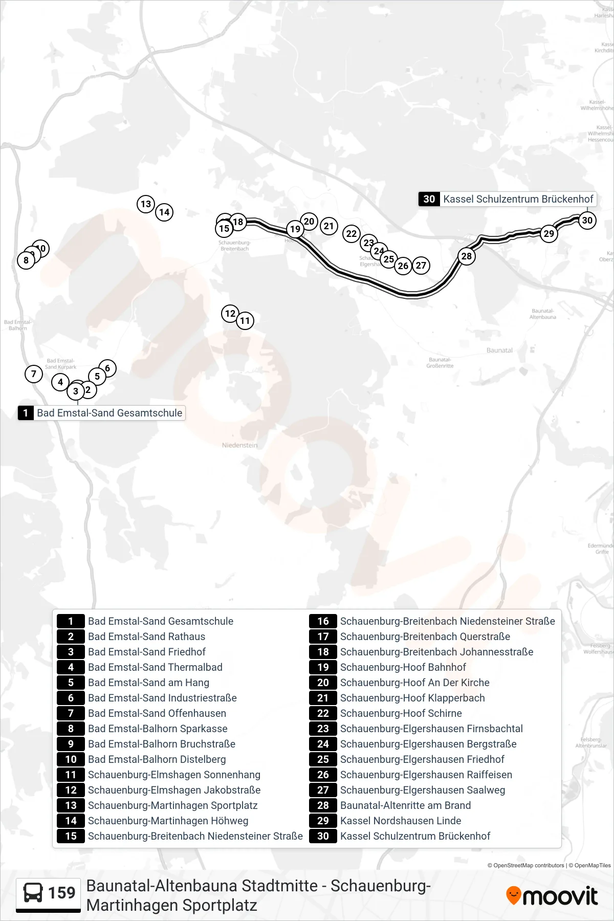
Stops list (159 - Brückenhof)
- Bad Emstal-Sand Gesamtschule
- Bad Emstal-Sand Rathaus
- Bad Emstal-Sand Friedhof
- Bad Emstal-Sand Thermalbad
- Bad Emstal-Sand am Hang
- Bad Emstal-Sand Industriestraße
- Bad Emstal-Sand Offenhausen
- Bad Emstal-Balhorn Sparkasse
- Bad Emstal-Balhorn Bruchstraße
- Bad Emstal-Balhorn Distelberg
- Schauenburg-Elmshagen Sonnenhang
- Schauenburg-Elmshagen Jakobstraße
- Schauenburg-Martinhagen Sportplatz
- Schauenburg-Martinhagen Höhweg
- Schauenburg-Breitenbach Niedensteiner Straße
- Schauenburg-Breitenbach Niedensteiner Straße
- Schauenburg-Breitenbach Querstraße
- Schauenburg-Breitenbach Johannesstraße
- Schauenburg-Hoof Bahnhof
- Schauenburg-Hoof An Der Kirche
- Schauenburg-Hoof Klapperbach
- Schauenburg-Hoof Schirne
- Schauenburg-Elgershausen Firnsbachtal
- Schauenburg-Elgershausen Bergstraße
- Schauenburg-Elgershausen Friedhof
- Schauenburg-Elgershausen Raiffeisen
- Schauenburg-Elgershausen Saalweg
- Baunatal-Altenritte am Brand
- Kassel Nordshausen Linde
- Kassel Schulzentrum Brückenhof
Change direction
- Route Map - 159 - Jugendzentrum
- Route Map - 159 - Stadtmitte
- Route Map - 159 - Elmshagen
- Route Map - 159 - Martinhagen
- Route Map - 159 - Parkstadion
- Route Map - 159 - Breitenbach
- Route Map - 159 - Breitenbach
- Route Map - 159 - Kassel Schulzentrum Brückenhof
- Route Map - 159 - Elgershausen
- Route Map - 159 - Elgershausen
- Route Map - 159 - Breitenbach Johannesstraße
- Route Map - 159 - Sand Gesamtschule
- Route Map - 159 - E.-Kästner-Schule