
15D Bus Route Map
View the 15D route map and see all 15D stops along the route. The map of 15D shows where the bus travels and the location of each stop, making it easy to understand the entire route at a glance.
Explore Bus Átha Cliath – Dublin Bus routes on the map and see where Bus Átha Cliath – Dublin Bus bus services operate. Use the 15D map to find bus stops and see how the 15D connects different areas along its trip.
All 15D stops on the map are displayed in route order, helping you follow the 15D bus from the first stop to the last.
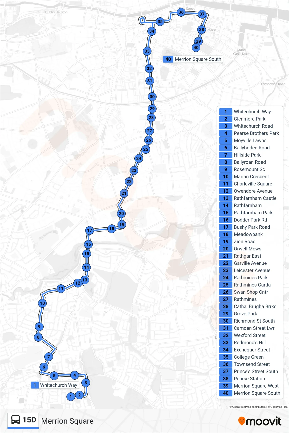
Stops list (15D - Merrion Square)
- Whitechurch Way
- Glenmore Park
- Whitechurch Road
- Pearse Brothers Park
- Moyville Lawns
- Ballyboden Road
- Hillside Park
- Ballyroan Road
- Rosemount Sc
- Marian Crescent
- Charleville Square
- Owendore Avenue
- Rathfarnham Castle
- Rathfarnham
- Rathfarnham Park
- Dodder Park Rd
- Bushy Park Road
- Meadowbank
- Zion Road
- Orwell Mews
- Rathgar East
- Garville Avenue
- Leicester Avenue
- Rathmines Park
- Rathmines Garda
- Swan Shop Cntr
- Rathmines
- Cathal Brugha Brrks
- Grove Park
- Richmond St South
- Camden Street Lwr
- Wexford Street
- Redmond's Hill
- Exchequer Street
- College Green
- Townsend Street
- Prince's Street South
- Pearse Station
- Merrion Square West
- Merrion Square South