
16 Bus Route Map
View the 16 route map and see all 16 stops along the route. The map of 16 shows where the bus travels and the location of each stop, making it easy to understand the entire route at a glance.
Explore MBTA routes on the map and see where MBTA bus services operate. Use the 16 map to find bus stops and see how the 16 connects different areas along its trip.
All 16 stops on the map are displayed in route order, helping you follow the 16 bus from the first stop to the last.
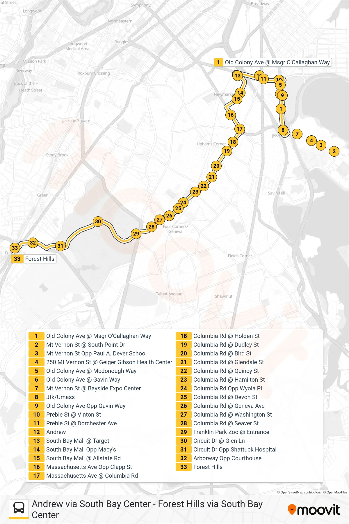
Stops list (16 - Forest Hills Via South Bay Center)
- Old Colony Ave @ Msgr O'Callaghan Way
- Mt Vernon St @ South Point Dr
- Mt Vernon St Opp Paul A. Dever School
- 250 Mt Vernon St @ Geiger Gibson Health Center
- Old Colony Ave @ Mcdonough Way
- Old Colony Ave @ Gavin Way
- Mt Vernon St @ Bayside Expo Center
- Jfk/Umass
- Old Colony Ave Opp Gavin Way
- Preble St @ Vinton St
- Preble St @ Dorchester Ave
- Andrew
- South Bay Mall @ Target
- South Bay Mall Opp Macy's
- South Bay Mall @ Allstate Rd
- Massachusetts Ave Opp Clapp St
- Massachusetts Ave @ Columbia Rd
- Columbia Rd @ Holden St
- Columbia Rd @ Dudley St
- Columbia Rd @ Bird St
- Columbia Rd @ Glendale St
- Columbia Rd @ Quincy St
- Columbia Rd @ Hamilton St
- Columbia Rd Opp Wyola Pl
- Columbia Rd @ Devon St
- Columbia Rd @ Geneva Ave
- Columbia Rd @ Washington St
- Columbia Rd @ Seaver St
- Franklin Park Zoo @ Entrance
- Circuit Dr @ Glen Ln
- Circuit Dr Opp Shattuck Hospital
- Arborway Opp Courthouse
- Forest Hills