
16 Bus Route Map
View the 16 route map and see all 16 stops along the route. The map of 16 shows where the bus travels and the location of each stop, making it easy to understand the entire route at a glance.
Explore Bus Átha Cliath – Dublin Bus routes on the map and see where Bus Átha Cliath – Dublin Bus bus services operate. Use the 16 map to find bus stops and see how the 16 connects different areas along its trip.
All 16 stops on the map are displayed in route order, helping you follow the 16 bus from the first stop to the last.
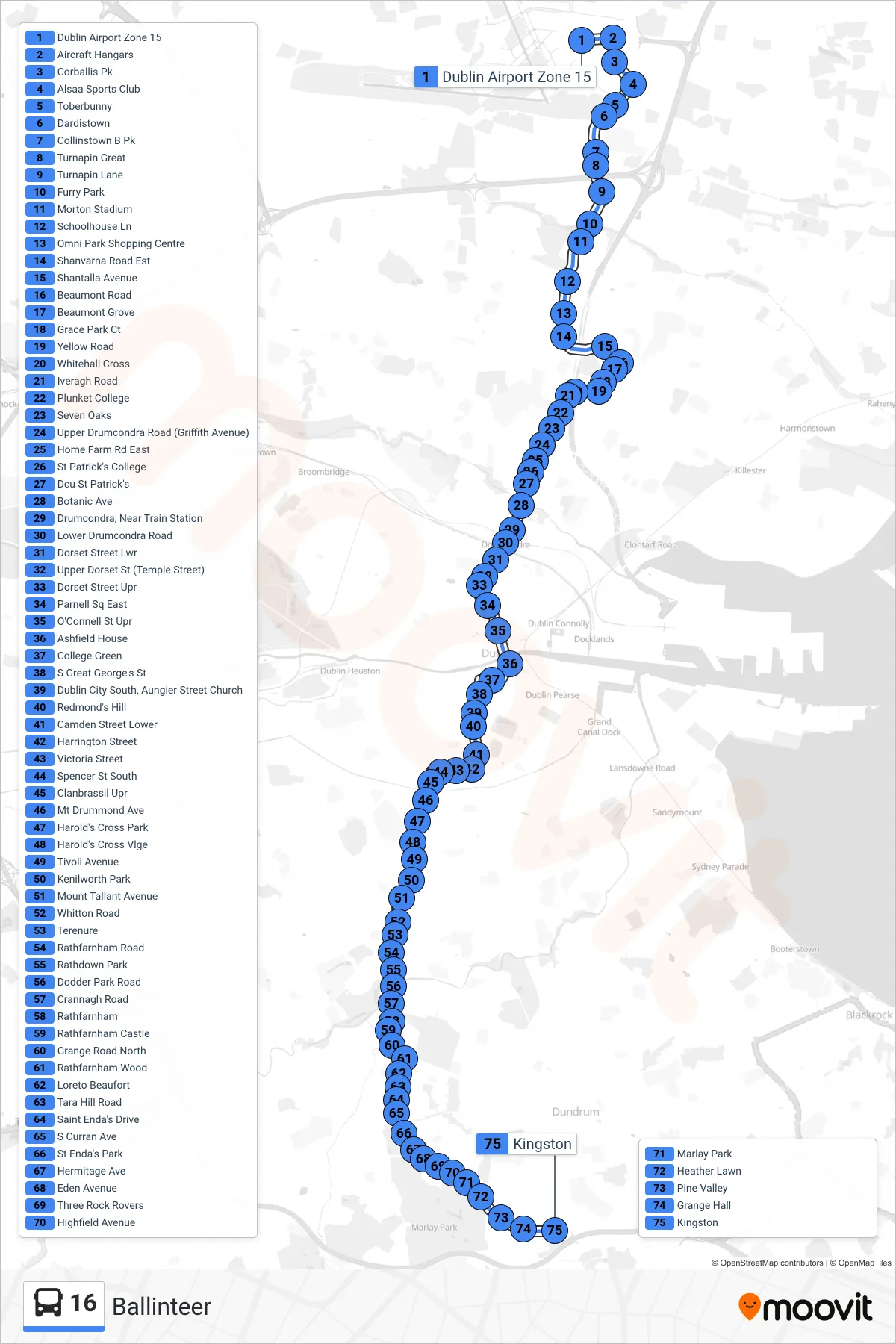
Stops list (16 - Ballinteer)
- Dublin Airport Zone 15
- Aircraft Hangars
- Corballis Pk
- Alsaa Sports Club
- Toberbunny
- Dardistown
- Collinstown B Pk
- Turnapin Great
- Turnapin Lane
- Furry Park
- Morton Stadium
- Schoolhouse Ln
- Omni Park Shopping Centre
- Shanvarna Road Est
- Shantalla Avenue
- Beaumont Road
- Beaumont Grove
- Grace Park Ct
- Yellow Road
- Whitehall Cross
- Iveragh Road
- Plunket College
- Seven Oaks
- Upper Drumcondra Road (Griffith Avenue)
- Home Farm Rd East
- St Patrick's College
- Dcu St Patrick's
- Botanic Ave
- Drumcondra, Near Train Station
- Lower Drumcondra Road
- Dorset Street Lwr
- Upper Dorset St (Temple Street)
- Dorset Street Upr
- Parnell Sq East
- O'Connell St Upr
- Ashfield House
- College Green
- S Great George's St
- Dublin City South, Aungier Street Church
- Redmond's Hill
- Camden Street Lower
- Harrington Street
- Victoria Street
- Spencer St South
- Clanbrassil Upr
- Mt Drummond Ave
- Harold's Cross Park
- Harold's Cross Vlge
- Tivoli Avenue
- Kenilworth Park
- Mount Tallant Avenue
- Whitton Road
- Terenure
- Rathfarnham Road
- Rathdown Park
- Dodder Park Road
- Crannagh Road
- Rathfarnham
- Rathfarnham Castle
- Grange Road North
- Rathfarnham Wood
- Loreto Beaufort
- Tara Hill Road
- Saint Enda's Drive
- S Curran Ave
- St Enda's Park
- Hermitage Ave
- Eden Avenue
- Three Rock Rovers
- Highfield Avenue
- Marlay Park
- Heather Lawn
- Pine Valley
- Grange Hall
- Kingston