
16 Light Rail Route Map
View the 16 route map and see all 16 stops along the route. The map of 16 shows where the light rail travels and the location of each stop, making it easy to understand the entire route at a glance.
Explore KVB Kölner Verkehrs-Betriebe AG routes on the map and see where KVB Kölner Verkehrs-Betriebe AG light rail services operate. Use the 16 map to find light rail stations and see how the 16 connects different areas along its trip.
All 16 stops on the map are displayed in route order, helping you follow the 16 light rail from the first station to the last.
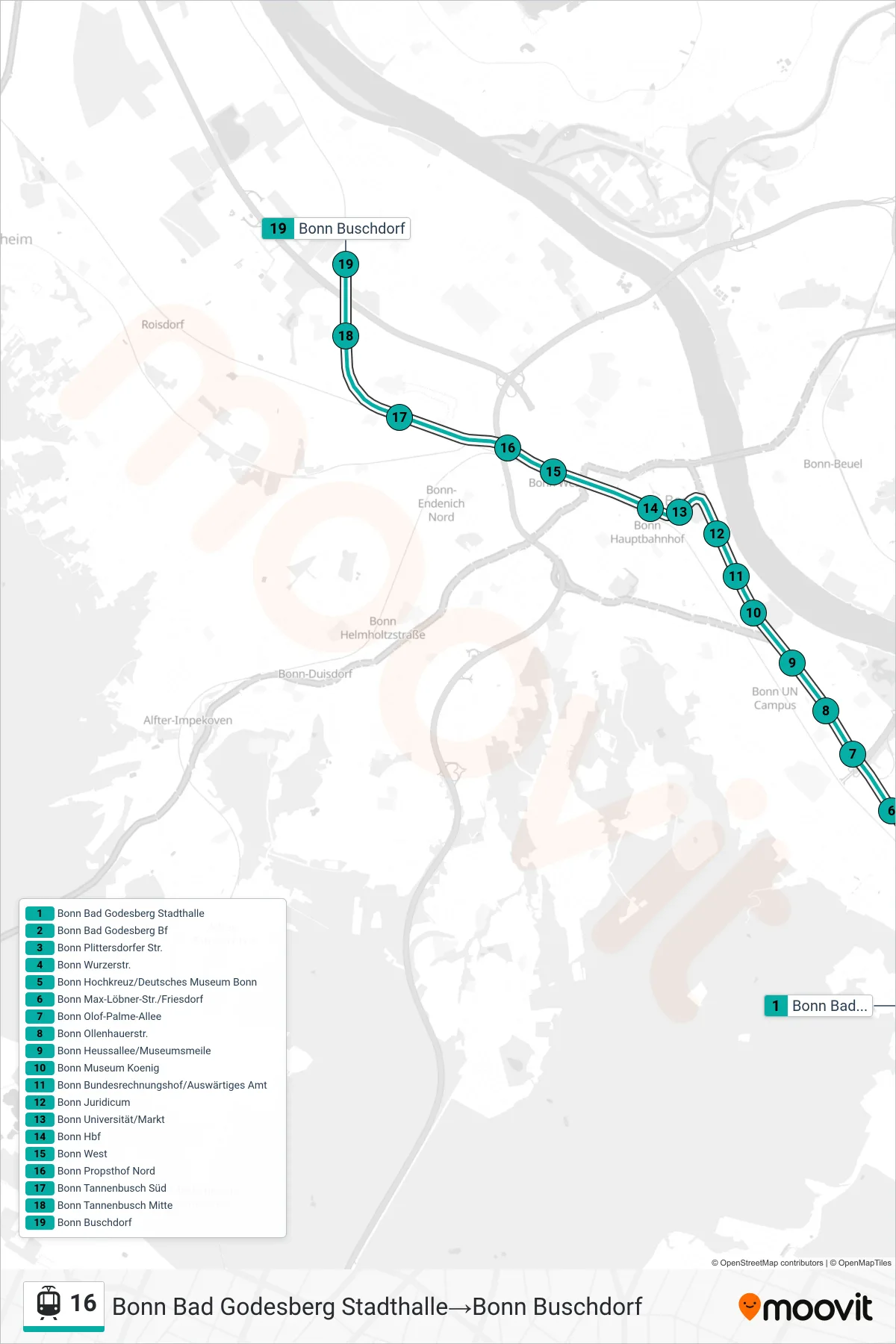

Stops list (16 - Bonn Bad Godesberg Stadthalle→Bonn Buschdorf)
- Bonn Bad Godesberg Stadthalle
- Bonn Bad Godesberg Bf
- Bonn Plittersdorfer Str.
- Bonn Wurzerstr.
- Bonn Hochkreuz/Deutsches Museum Bonn
- Bonn Max-Löbner-Str./Friesdorf
- Bonn Olof-Palme-Allee
- Bonn Ollenhauerstr.
- Bonn Heussallee/Museumsmeile
- Bonn Museum Koenig
- Bonn Museum Koenig
- Bonn Bundesrechnungshof/Auswärtiges Amt
- Bonn Bundesrechnungshof/Auswärtiges Amt
- Bonn Juridicum
- Bonn Juridicum
- Bonn Universität/Markt
- Bonn Universität/Markt
- Bonn Hbf
- Bonn West
- Bonn Propsthof Nord
- Bonn Tannenbusch Süd
- Bonn Tannenbusch Mitte
- Bonn Buschdorf
Change direction
- Route Map - 16 - Köln Niehl Sebastianstr.→Köln Ubierring
- Route Map - 16 - Köln Severinstr.→Bonn Hbf
- Route Map - 16 - Köln Reichenspergerplatz→Köln Ubierring
- Route Map - 16 - Wesseling Wesseling→Bonn Bad Godesberg Stadthalle
- Route Map - 16 - Köln Ubierring→Köln Niehl Sebastianstr.
- Route Map - 16 - Köln Ubierring→Wesseling Wesseling
- Route Map - 16 - Bonn Bad Godesberg Stadthalle→Köln Niehl Sebastianstr.
- Route Map - 16 - Bonn Hbf→Köln Niehl Sebastianstr.
- Route Map - 16 - Bonn Bad Godesberg Stadthalle→Wesseling Wesseling
- Route Map - 16 - Bonn Hbf→Köln Sürth Bf
- Route Map - 16 - Bonn Hbf→Bonn Buschdorf
- Route Map - 16 - Köln Niehl Sebastianstr.→Bonn Hbf
- Route Map - 16 - Wesseling Wesseling→Bonn West
- Route Map - 16 - Köln Sürth Bf→Köln Niehl Sebastianstr.
- Route Map - 16 - Bonn West→Bonn Bad Godesberg Stadthalle
- Route Map - 16 - Wesseling Wesseling→Bonn Hbf
- Route Map - 16 - Köln Sürth Bf→Wesseling Wesseling
- Route Map - 16 - Köln Severinstr.→Wesseling Wesseling
- Route Map - 16 - Bonn Buschdorf→Bonn Bad Godesberg Stadthalle
- Route Map - 16 - Köln Severinstr.→Bonn Bad Godesberg Stadthalle
- Route Map - 16 - Köln Niehl Sebastianstr.→Köln Sürth Bf
- Route Map - 16 - Köln Sürth Bf→Köln Severinstr.
- Route Map - 16 - Köln Ubierring→Köln Barbarossaplatz
- Route Map - 16 - Köln Sürth Bf→Bonn Hbf
- Route Map - 16 - Wesseling Wesseling→Köln Niehl Sebastianstr.
- Route Map - 16 - Köln Sürth Bf→Bonn Bad Godesberg Stadthalle
- Route Map - 16 - Wesseling Wesseling→Köln Sürth Bf
- Route Map - 16 - Köln Severinstr.→Köln Sürth Bf
- Route Map - 16 - Köln Niehl Sebastianstr.→Wesseling Wesseling
- Route Map - 16 - Bonn Bad Godesberg Stadthalle→Köln Severinstr.
- Route Map - 16 - Wesseling Wesseling→Köln Severinstr.
- Route Map - 16 - Köln Niehl Sebastianstr.→Bonn Bad Godesberg Stadthalle
- Route Map - 16 - Bonn Buschdorf→Bonn Hbf
- Route Map - 16 - Bonn Hbf→Wesseling Wesseling
- Route Map - 16 - Bonn Brühler Str.→Bonn West