
16 Bus Route Map
View the 16 route map and see all 16 stops along the route. The map of 16 shows where the bus travels and the location of each stop, making it easy to understand the entire route at a glance.
Explore County Connection routes on the map and see where County Connection bus services operate. Use the 16 map to find bus stops and see how the 16 connects different areas along its trip.
All 16 stops on the map are displayed in route order, helping you follow the 16 bus from the first stop to the last.
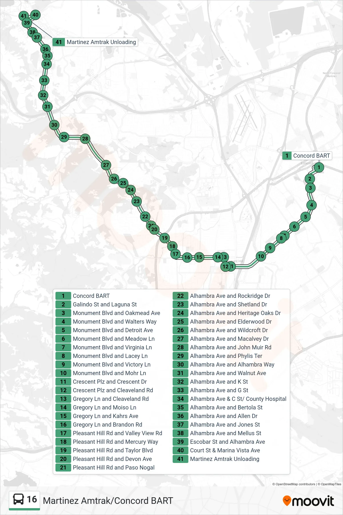
Stops list (16 - Martinez Amtrak via Downtown Pleasant Hill)
- Concord BART
- Galindo St and Laguna St
- Monument Blvd and Oakmead Ave
- Monument Blvd and Walters Way
- Monument Blvd and Detroit Ave
- Monument Blvd and Meadow Ln
- Monument Blvd and Virginia Ln
- Monument Blvd and Lacey Ln
- Monument Blvd and Victory Ln
- Monument Blvd and Mohr Ln
- Crescent Plz and Crescent Dr
- Crescent Plz and Cleaveland Rd
- Gregory Ln and Cleaveland Rd
- Gregory Ln and Moiso Ln
- Gregory Ln and Kahrs Ave
- Gregory Ln and Brandon Rd
- Pleasant Hill Rd and Valley View Rd
- Pleasant Hill Rd and Mercury Way
- Pleasant Hill Rd and Taylor Blvd
- Pleasant Hill Rd and Devon Ave
- Pleasant Hill Rd and Paso Nogal
- Alhambra Ave and Rockridge Dr
- Alhambra Ave and Shetland Dr
- Alhambra Ave and Heritage Oaks Dr
- Alhambra Ave and Elderwood Dr
- Alhambra Ave and Wildcroft Dr
- Alhambra Ave and Macalvey Dr
- Alhambra Ave and John Muir Rd
- Alhambra Ave and Phylis Ter
- Alhambra Ave and Alhambra Way
- Alhambra Ave and Walnut Ave
- Alhambra Ave and K St
- Alhambra Ave and G St
- Alhambra Ave & C St/ County Hospital
- Alhambra Ave and Bertola St
- Alhambra Ave and Allen Dr
- Alhambra Ave and Jones St
- Alhambra Ave and Mellus St
- Escobar St and Alhambra Ave
- Court St & Marina Vista Ave
- Martinez Amtrak Unloading