
166 Bus Route Map
View the 166 route map and see all 166 stops along the route. The map of 166 shows where the bus travels and the location of each stop, making it easy to understand the entire route at a glance.
Explore Nateev Express routes on the map and see where Nateev Express bus services operate. Use the 166 map to find bus stops and see how the 166 connects different areas along its trip.
All 166 stops on the map are displayed in route order, helping you follow the 166 bus from the first stop to the last.
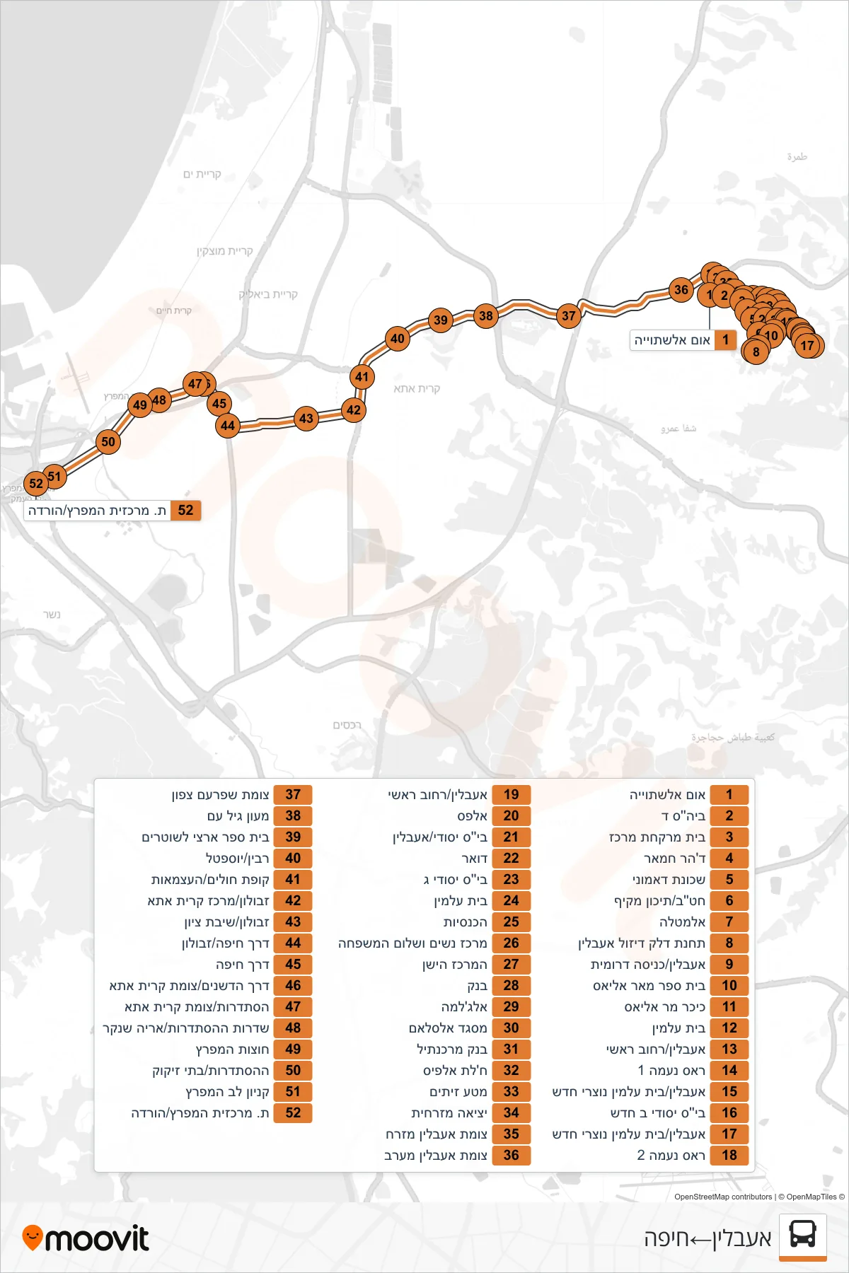
Stops list (166 - I'billin→Haifa)
- Um Al-Shtuyyeh
- School D
- Central Pharmacy
- Dahr Hamar
- Damuni Neighborhood
- Middle/High School Complex
- Al-Matla
- Ibillin Diesel Gas Station
- Iblin/South Entrance
- Mar Elias School
- Mar Elias Square
- Cemetery
- Iblin/Main Street
- Ras Naama 1
- Iblin/New Christian Cemetery
- New Elementary School B
- Iblin/New Christian Cemetery
- Ras Naama 2
- Iblin/Main Street
- Alpas
- Elementary School/I'bilin
- Post Office
- Elementary School C
- Cemetery
- The Churches
- Women and Family Peace Center
- Old Center
- Bank
- Al-Jalama
- Al-Salam Mosque
- Bank Mercantile
- Khalet al-Fis
- Olive Grove
- Eastern Exit
- Iblin East Junction
- Iblin West Junction
- Shfaram North Junction
- Gil Am Center
- National Police School
- Rabin/Yoseftal
- Health Clinic/HaAtzmaut
- Zevulun/Kiryat Ata Center
- Zevulun/Shivat Zion
- Haifa Road/Zevulun
- Haifa Road
- Hadeshanim Road/Kiryat Ata Junction
- Histadrut/Kiryat Ata Junction
- Histadrut Boulevard/Arie Shenkar
- Hutzot HaMifratz
- HaHistadrut/Oil Refineries
- Lev HaMifratz Mall
- HaMifratz Central Station/Drop Off