
168 Bus Route Map
View the 168 route map and see all 168 stops along the route. The map of 168 shows where the bus travels and the location of each stop, making it easy to understand the entire route at a glance.
Explore Electra Afikim Transport routes on the map and see where Electra Afikim Transport bus services operate. Use the 168 map to find bus stops and see how the 168 connects different areas along its trip.
All 168 stops on the map are displayed in route order, helping you follow the 168 bus from the first stop to the last.
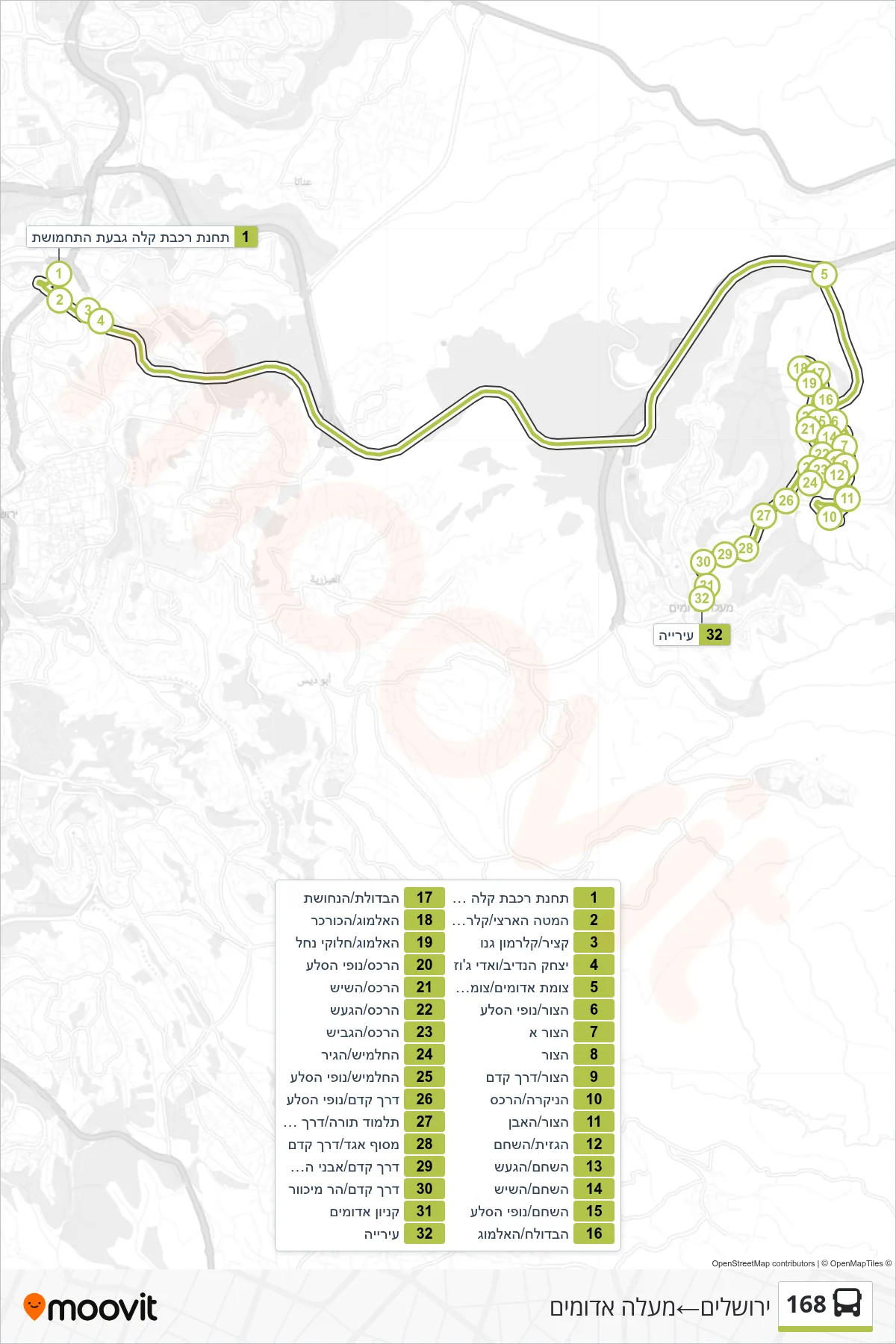
Stops list (168 - Jerusalem→Ma'ale Adumim)
- Light Rail Station Ammunition Hill
- National Headquarters/Clermont-Ganneau
- Katzir/Clermont-Ganneau
- Yitzhak HaNadiv/Wadi Joz
- Adumim Junction/Camp Yishai Junction
- HaTzur/Nofei HaSela
- HaTzur A
- HaTzur
- HaTzur/Kedem Road
- HaNikra/HaReches
- HaTzur/HaEven
- HaGazit/HaShaham
- HaShaham/HaGaash
- HaShaham/HaShayish
- HaShaham/Nofei HaSela
- HaBdolach/HaAlmog
- HaBdolach/HaNechoshet
- HaAlmog/HaKurkar
- HaAlmog/Halukei Nachal
- HaReches/Nofei HaSela
- HaRechess/HaShayish
- HaReches/HaGaash
- HaReches/HaGavish
- HaHalamish/HaGir
- HaHalamish/Nofei HaSela
- Kedem Road/Nofei HaSela
- Talmud Torah/Derech Kedem
- Egged Terminal/Derech Kedem
- Kedem Road/Avnei HaChoshen
- Kedem Road/Mount Michvar
- Adumim Mall
- City Hall