
17 Bus Route Map
View the 17 route map and see all 17 stops along the route. The map of 17 shows where the bus travels and the location of each stop, making it easy to understand the entire route at a glance.
Explore Start routes on the map and see where Start bus services operate. Use the 17 map to find bus stops and see how the 17 connects different areas along its trip.
All 17 stops on the map are displayed in route order, helping you follow the 17 bus from the first stop to the last.
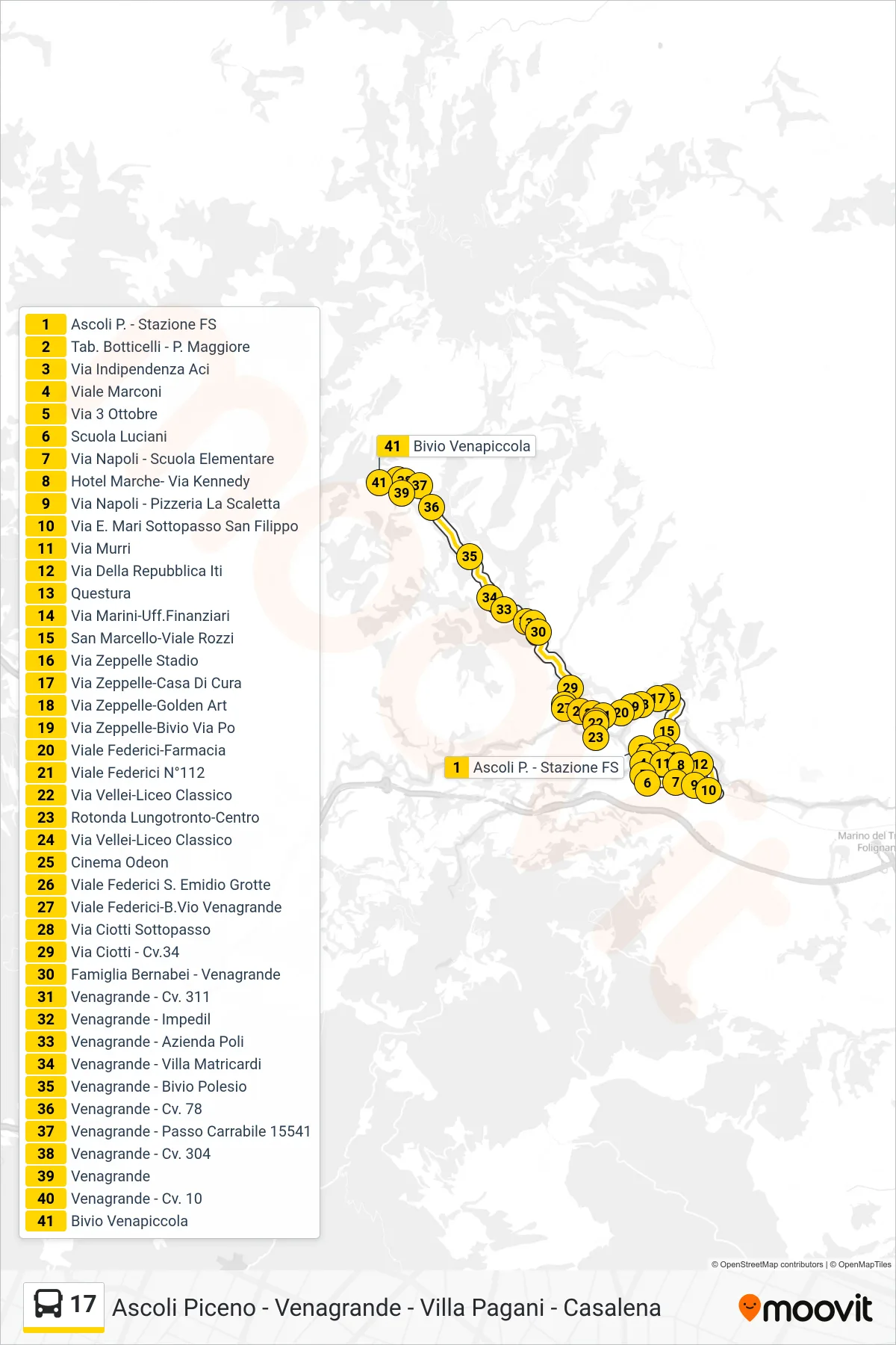
Stops list (17 - Venapiccola Junction)
- Ascoli Piceno - Railway Station
- Botticelli Stop - P. Maggiore
- Independence Street ACI
- Marconi Avenue
- October 3rd Street
- Luciani School
- Naples Street - Elementary School
- Hotel Marche - Via Kennedy
- Naples Street - La Scaletta Pizzeria
- E. Mari Street San Filippo Underpass
- Murri Street
- Via Della Repubblica ITI
- Police Headquarters
- Marini Street-Financial Offices
- San Marcello-Viale Rozzi
- Zeppelle Stadium Street
- Via Zeppelle-Nursing Home
- Zeppelle Street-Golden Art
- Zeppelle Street-Po Street Junction
- Federici Avenue-Pharmacy
- Federici Avenue #112
- Via Vellei-Classical High School
- Lungotronto Roundabout-Center
- Vellei Street-Classical High School
- Odeon Cinema
- Federici Avenue S. Emidio Caves
- Viale Federici-B.Vio Venagrande
- Via Ciotti Underpass
- Via Ciotti - No.34
- Bernabei Family - Venagrande
- Venagrande - Curve 311
- Venagrande - Impedil
- Venagrande - Poli Company
- Venagrande - Villa Matricardi
- Venagrande - Polesio Junction
- Venagrande - Civic 78
- Venagrande - Driveway 15541
- Venagrande - Curve 304
- Venagrande
- Venagrande - No. 10
- Venapiccola Junction