
17 Bus Route Map
View the 17 route map and see all 17 stops along the route. The map of 17 shows where the bus travels and the location of each stop, making it easy to understand the entire route at a glance.
Explore Rhode Island Public Transit Authority routes on the map and see where Rhode Island Public Transit Authority bus services operate. Use the 17 map to find bus stops and see how the 17 connects different areas along its trip.
All 17 stops on the map are displayed in route order, helping you follow the 17 bus from the first stop to the last.
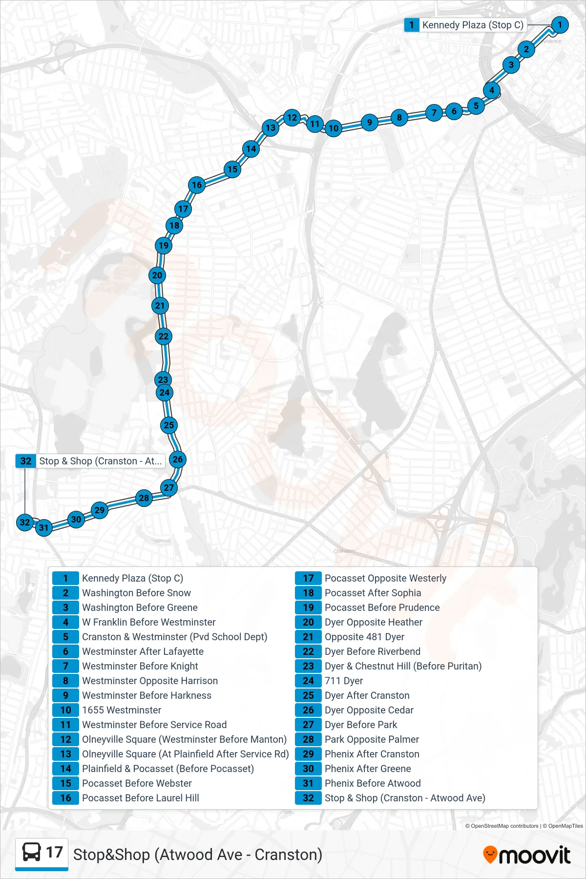
Stops list (17 - Stop&Shop (Atwood Ave - Cranston))
- Kennedy Plaza (Stop C)
- Washington Before Snow
- Washington Before Greene
- W Franklin Before Westminster
- Cranston & Westminster (Pvd School Dept)
- Westminster After Lafayette
- Westminster Before Knight
- Westminster Opposite Harrison
- Westminster Before Harkness
- 1655 Westminster
- Westminster Before Service Road
- Olneyville Square (Westminster Before Manton)
- Olneyville Square (At Plainfield After Service Rd)
- Plainfield & Pocasset (Before Pocasset)
- Pocasset Before Webster
- Pocasset Before Laurel Hill
- Pocasset Opposite Westerly
- Pocasset After Sophia
- Pocasset Before Prudence
- Dyer Opposite Heather
- Opposite 481 Dyer
- Dyer Before Riverbend
- Dyer & Chestnut Hill (Before Puritan)
- 711 Dyer
- Dyer After Cranston
- Dyer Opposite Cedar
- Dyer Before Park
- Park Opposite Palmer
- Phenix After Cranston
- Phenix After Greene
- Phenix Before Atwood
- Stop & Shop (Cranston - Atwood Ave)