
17 Bus Route Map
View the 17 route map and see all 17 stops along the route. The map of 17 shows where the bus travels and the location of each stop, making it easy to understand the entire route at a glance.
Explore MEVA routes on the map and see where MEVA bus services operate. Use the 17 map to find bus stops and see how the 17 connects different areas along its trip.
All 17 stops on the map are displayed in route order, helping you follow the 17 bus from the first stop to the last.
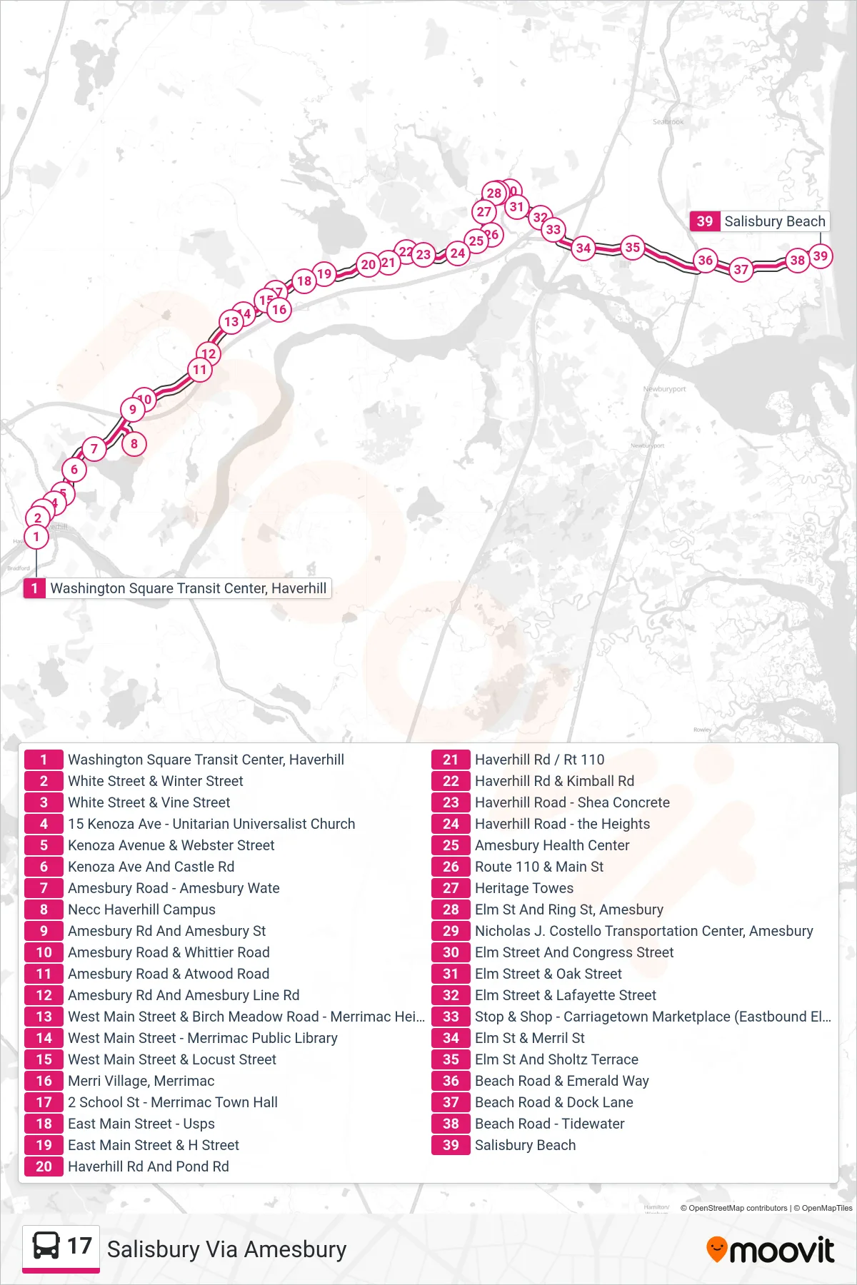
Stops list (17 - Salisbury Via Amesbury)
- Washington Square Transit Center, Haverhill
- White Street & Winter Street
- White Street & Vine Street
- 15 Kenoza Ave - Unitarian Universalist Church
- Kenoza Avenue & Webster Street
- Kenoza Ave And Castle Rd
- Amesbury Road - Amesbury Wate
- Necc Haverhill Campus
- Amesbury Rd And Amesbury St
- Amesbury Road & Whittier Road
- Amesbury Road & Atwood Road
- Amesbury Rd And Amesbury Line Rd
- West Main Street & Birch Meadow Road - Merrimac Heights Academy
- West Main Street - Merrimac Public Library
- West Main Street & Locust Street
- Merri Village, Merrimac
- 2 School St - Merrimac Town Hall
- East Main Street - Usps
- East Main Street & H Street
- Haverhill Rd And Pond Rd
- Haverhill Rd / Rt 110
- Haverhill Rd & Kimball Rd
- Haverhill Road - Shea Concrete
- Haverhill Road - the Heights
- Amesbury Health Center
- Route 110 & Main St
- Heritage Towes
- Elm St And Ring St, Amesbury
- Nicholas J. Costello Transportation Center, Amesbury
- Elm Street And Congress Street
- Elm Street & Oak Street
- Elm Street & Lafayette Street
- Stop & Shop - Carriagetown Marketplace (Eastbound Elm St)
- Elm St & Merril St
- Elm St And Sholtz Terrace
- Beach Road & Emerald Way
- Beach Road & Dock Lane
- Beach Road - Tidewater
- Salisbury Beach