
17 Bus Route Map
View the 17 route map and see all 17 stops along the route. The map of 17 shows where the bus travels and the location of each stop, making it easy to understand the entire route at a glance.
Explore Dan routes on the map and see where Dan bus services operate. Use the 17 map to find bus stops and see how the 17 connects different areas along its trip.
All 17 stops on the map are displayed in route order, helping you follow the 17 bus from the first stop to the last.
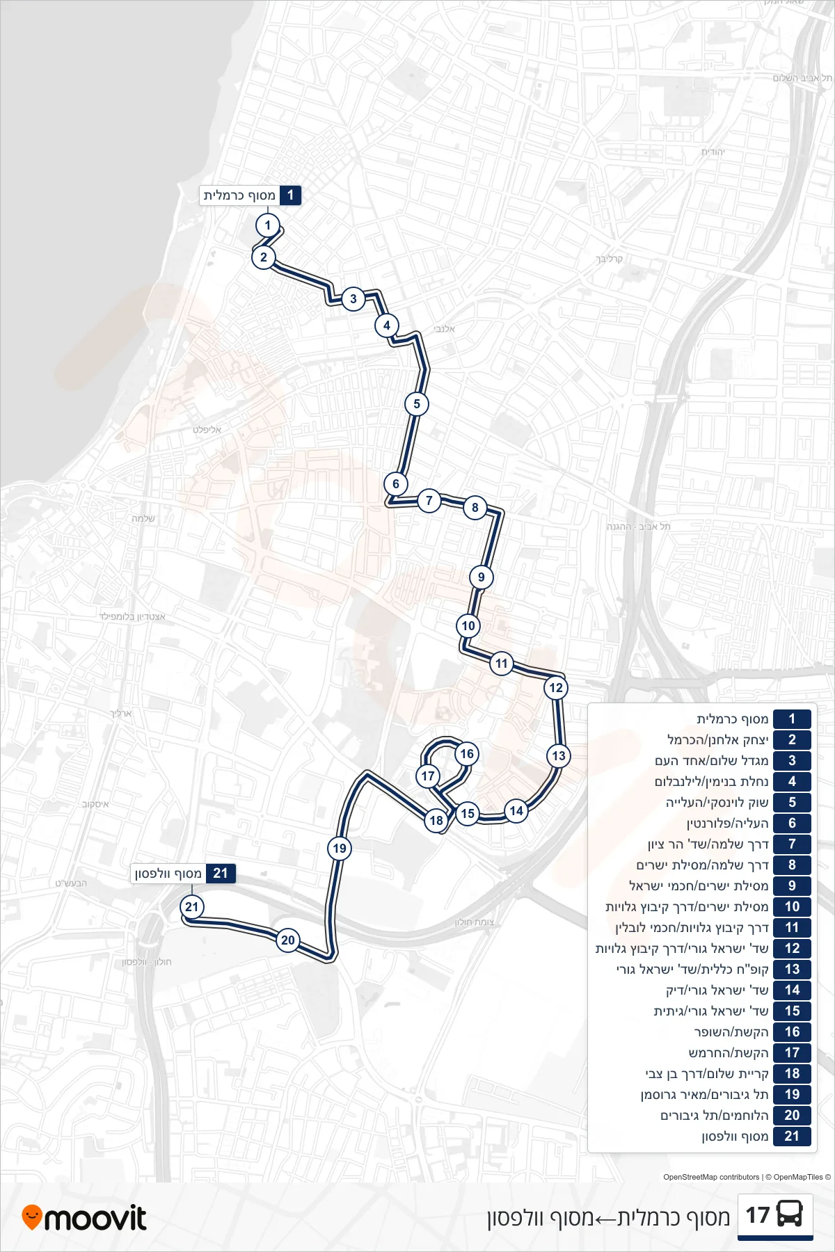
Stops list (17 - Carmelit Terminal→Wolfson Terminal)
- Carmelit Terminal
- Yitzhak Elhanan/HaCarmel
- Shalom Tower/Ahad Ha'am
- Nahalat Binyamin/Lilienblum
- Levinsky Market/HaAliya
- HaAliya/Florentin
- Derech Shlomo/Har Zion Blvd
- Shlomo Road/Mesilat Yesharim
- Mesilat Yesharim/Chachmei Israel
- Mesilat Yesharim/Kibbutz Galuyot Road
- Kibbutz Galuyot Road/Chachmei Lublin
- Israel Guri Blvd/Kibbutz Galuyot Road
- Clalit Health/Israel Guri Blvd
- Israel Guri Blvd/Dick
- Israel Guri Boulevard/Gitit
- HaKeshet/HaShofar
- HaKeshet/HaHermesh
- Kiryat Shalom/Ben Zvi Road
- Tel Giborim/Meir Grossman
- HaLochamim/Tel Giborim
- Wolfson Terminal