
17 Bus Route Map
View the 17 route map and see all 17 stops along the route. The map of 17 shows where the bus travels and the location of each stop, making it easy to understand the entire route at a glance.
Explore Autobuses routes on the map and see where Autobuses bus services operate. Use the 17 map to find bus stops and see how the 17 connects different areas along its trip.
All 17 stops on the map are displayed in route order, helping you follow the 17 bus from the first stop to the last.
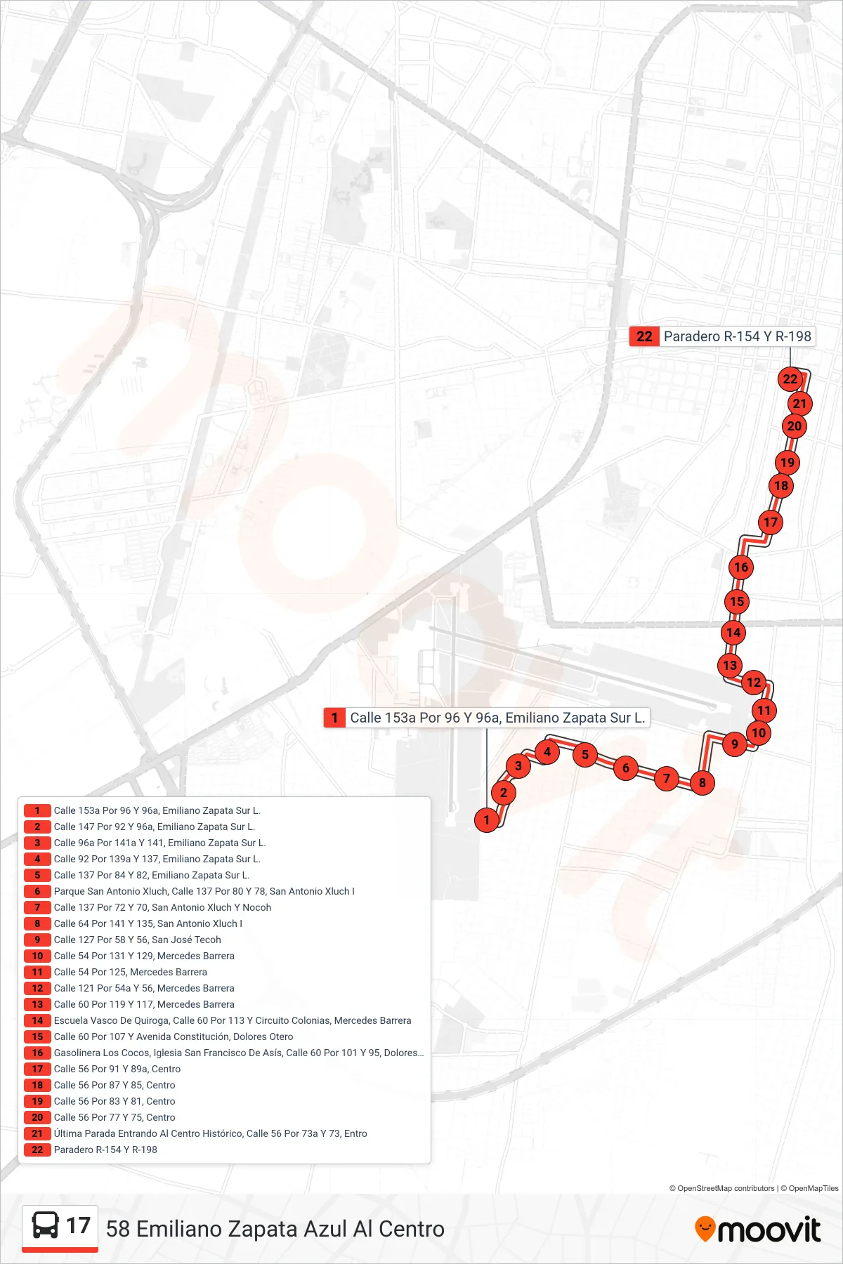
Stops list (17 - 58 Emiliano Zapata Azul Al Centro)
- Calle 153a Por 96 Y 96a, Emiliano Zapata Sur L.
- Calle 147 Por 92 Y 96a, Emiliano Zapata Sur L.
- Calle 96a Por 141a Y 141, Emiliano Zapata Sur L.
- Calle 92 Por 139a Y 137, Emiliano Zapata Sur L.
- Calle 137 Por 84 Y 82, Emiliano Zapata Sur L.
- Parque San Antonio Xluch, Calle 137 Por 80 Y 78, San Antonio Xluch I
- Calle 137 Por 72 Y 70, San Antonio Xluch Y Nocoh
- Calle 64 Por 141 Y 135, San Antonio Xluch I
- Calle 127 Por 58 Y 56, San José Tecoh
- Calle 54 Por 131 Y 129, Mercedes Barrera
- Calle 54 Por 125, Mercedes Barrera
- Calle 121 Por 54a Y 56, Mercedes Barrera
- Calle 60 Por 119 Y 117, Mercedes Barrera
- Escuela Vasco De Quiroga, Calle 60 Por 113 Y Circuito Colonias, Mercedes Barrera
- Calle 60 Por 107 Y Avenida Constitución, Dolores Otero
- Gasolinera Los Cocos, Iglesia San Francisco De Asís, Calle 60 Por 101 Y 95, Dolores Otero
- Calle 56 Por 91 Y 89a, Centro
- Calle 56 Por 87 Y 85, Centro
- Calle 56 Por 83 Y 81, Centro
- Calle 56 Por 77 Y 75, Centro
- Última Parada Entrando Al Centro Histórico, Calle 56 Por 73a Y 73, Entro
- Paradero R-154 Y R-198