
17 Bus Route Map
View the 17 route map and see all 17 stops along the route. The map of 17 shows where the bus travels and the location of each stop, making it easy to understand the entire route at a glance.
Explore Stadtwerke Münster GmbH routes on the map and see where Stadtwerke Münster GmbH bus services operate. Use the 17 map to find bus stops and see how the 17 connects different areas along its trip.
All 17 stops on the map are displayed in route order, helping you follow the 17 bus from the first stop to the last.
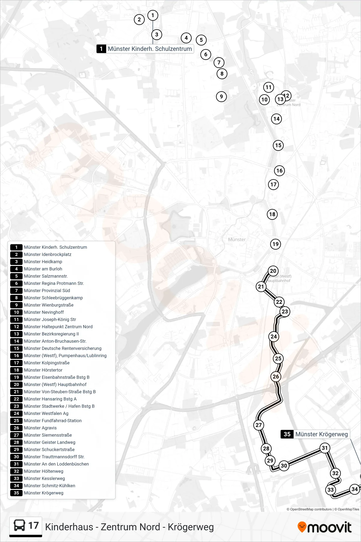
Stops list (17 - Krögerweg)
- Münster Kinderh. Schulzentrum
- Münster Idenbrockplatz
- Münster Heidkamp
- Münster am Burloh
- Münster Salzmannstr.
- Münster Regina Protmann Str.
- Münster Provinzial Süd
- Münster Schleebrüggenkamp
- Münster Wienburgstraße
- Münster Nevinghoff
- Münster Joseph-König Str
- Münster Haltepunkt Zentrum Nord
- Münster Bezirksregierung II
- Münster Anton-Bruchausen-Str.
- Münster Deutsche Rentenversicherung
- Münster (Westf), Pumpenhaus/Lublinring
- Münster Kolpingstraße
- Münster Hörstertor
- Münster Eisenbahnstraße Bstg B
- Münster (Westf) Hauptbahnhof
- Münster Von-Steuben-Straße Bstg B
- Münster Hansaring Bstg A
- Münster Stadtwerke / Hafen Bstg B
- Münster Westfalen Ag
- Münster Fundfahrrad-Station
- Münster Agravis
- Münster Siemensstraße
- Münster Geister Landweg
- Münster Schuckertstraße
- Münster Trauttmannsdorff Str.
- Münster An den Loddenbüschen
- Münster Höltenweg
- Münster Kesslerweg
- Münster Schmitz-Kühlken
- Münster Krögerweg