
17 Bus Route Map
View the 17 route map and see all 17 stops along the route. The map of 17 shows where the bus travels and the location of each stop, making it easy to understand the entire route at a glance.
Explore Marin Transit routes on the map and see where Marin Transit bus services operate. Use the 17 map to find bus stops and see how the 17 connects different areas along its trip.
All 17 stops on the map are displayed in route order, helping you follow the 17 bus from the first stop to the last.
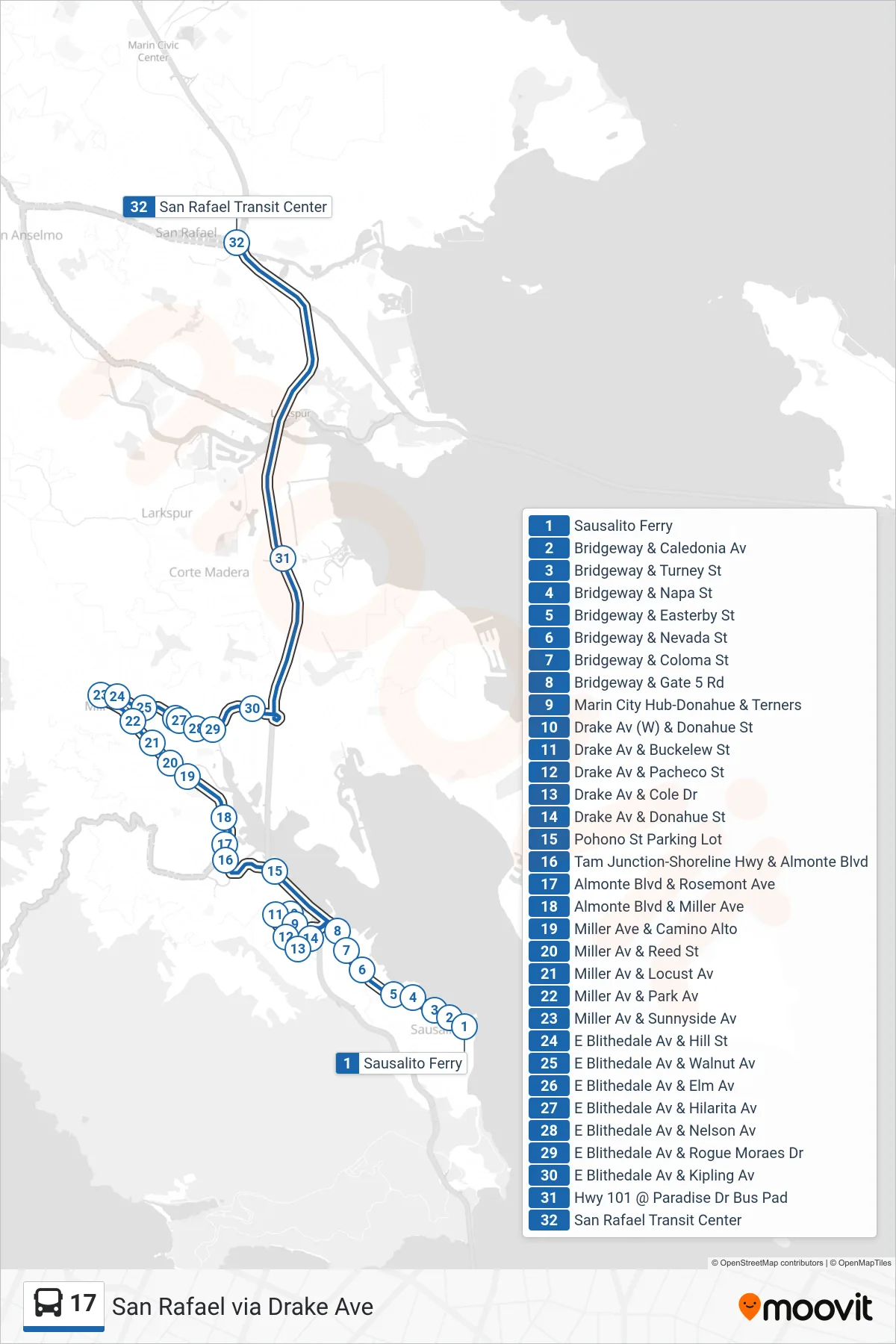
Stops list (17 - San Rafael via Drake Ave)
- Sausalito Ferry
- Bridgeway & Caledonia Av
- Bridgeway & Turney St
- Bridgeway & Napa St
- Bridgeway & Easterby St
- Bridgeway & Nevada St
- Bridgeway & Coloma St
- Bridgeway & Gate 5 Rd
- Marin City Hub-Donahue & Terners
- Drake Av (W) & Donahue St
- Drake Av & Buckelew St
- Drake Av & Pacheco St
- Drake Av & Cole Dr
- Drake Av & Donahue St
- Pohono St Parking Lot
- Tam Junction-Shoreline Hwy & Almonte Blvd
- Almonte Blvd & Rosemont Ave
- Almonte Blvd & Miller Ave
- Miller Ave & Camino Alto
- Miller Av & Reed St
- Miller Av & Locust Av
- Miller Av & Park Av
- Miller Av & Sunnyside Av
- E Blithedale Av & Hill St
- E Blithedale Av & Walnut Av
- E Blithedale Av & Elm Av
- E Blithedale Av & Hilarita Av
- E Blithedale Av & Nelson Av
- E Blithedale Av & Rogue Moraes Dr
- E Blithedale Av & Kipling Av
- Hwy 101 @ Paradise Dr Bus Pad
- San Rafael Transit Center