
170 Bus Route Map
View the 170 route map and see all 170 stops along the route. The map of 170 shows where the bus travels and the location of each stop, making it easy to understand the entire route at a glance.
Explore EVAG Bus routes on the map and see where EVAG Bus bus services operate. Use the 170 map to find bus stops and see how the 170 connects different areas along its trip.
All 170 stops on the map are displayed in route order, helping you follow the 170 bus from the first stop to the last.
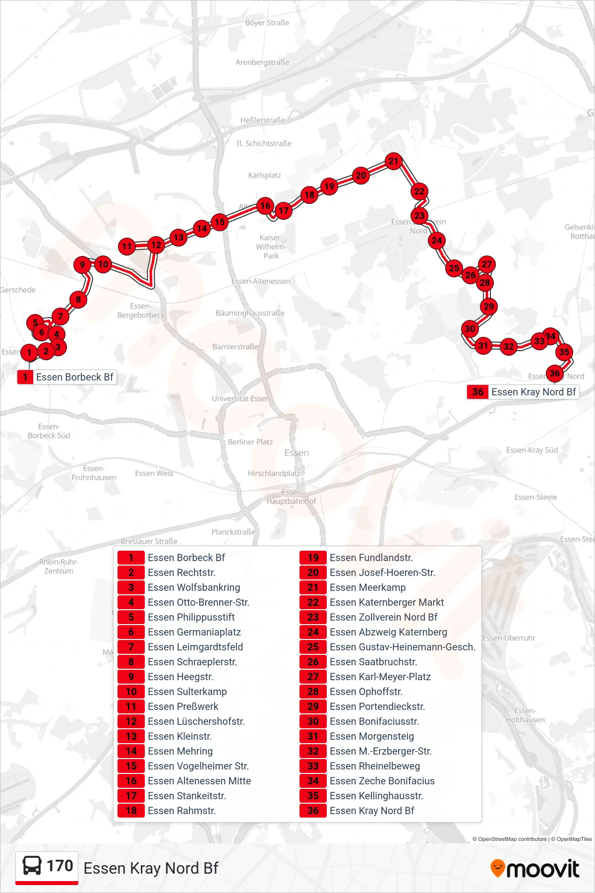
Stops list (170 - Essen Kray Nord Bf)
- Essen Borbeck Bf
- Essen Rechtstr.
- Essen Wolfsbankring
- Essen Otto-Brenner-Str.
- Essen Philippusstift
- Essen Germaniaplatz
- Essen Leimgardtsfeld
- Essen Schraeplerstr.
- Essen Heegstr.
- Essen Sulterkamp
- Essen Preßwerk
- Essen Lüschershofstr.
- Essen Kleinstr.
- Essen Mehring
- Essen Vogelheimer Str.
- Essen Altenessen Mitte
- Essen Stankeitstr.
- Essen Rahmstr.
- Essen Fundlandstr.
- Essen Josef-Hoeren-Str.
- Essen Meerkamp
- Essen Katernberger Markt
- Essen Zollverein Nord Bf
- Essen Abzweig Katernberg
- Essen Gustav-Heinemann-Gesch.
- Essen Saatbruchstr.
- Essen Karl-Meyer-Platz
- Essen Ophoffstr.
- Essen Portendieckstr.
- Essen Bonifaciusstr.
- Essen Morgensteig
- Essen M.-Erzberger-Str.
- Essen Rheinelbeweg
- Essen Zeche Bonifacius
- Essen Kellinghausstr.
- Essen Kray Nord Bf