
172 Bus Route Map
View the 172 route map and see all 172 stops along the route. The map of 172 shows where the bus travels and the location of each stop, making it easy to understand the entire route at a glance.
Explore Movia routes on the map and see where Movia bus services operate. Use the 172 map to find bus stops and see how the 172 connects different areas along its trip.
All 172 stops on the map are displayed in route order, helping you follow the 172 bus from the first stop to the last.
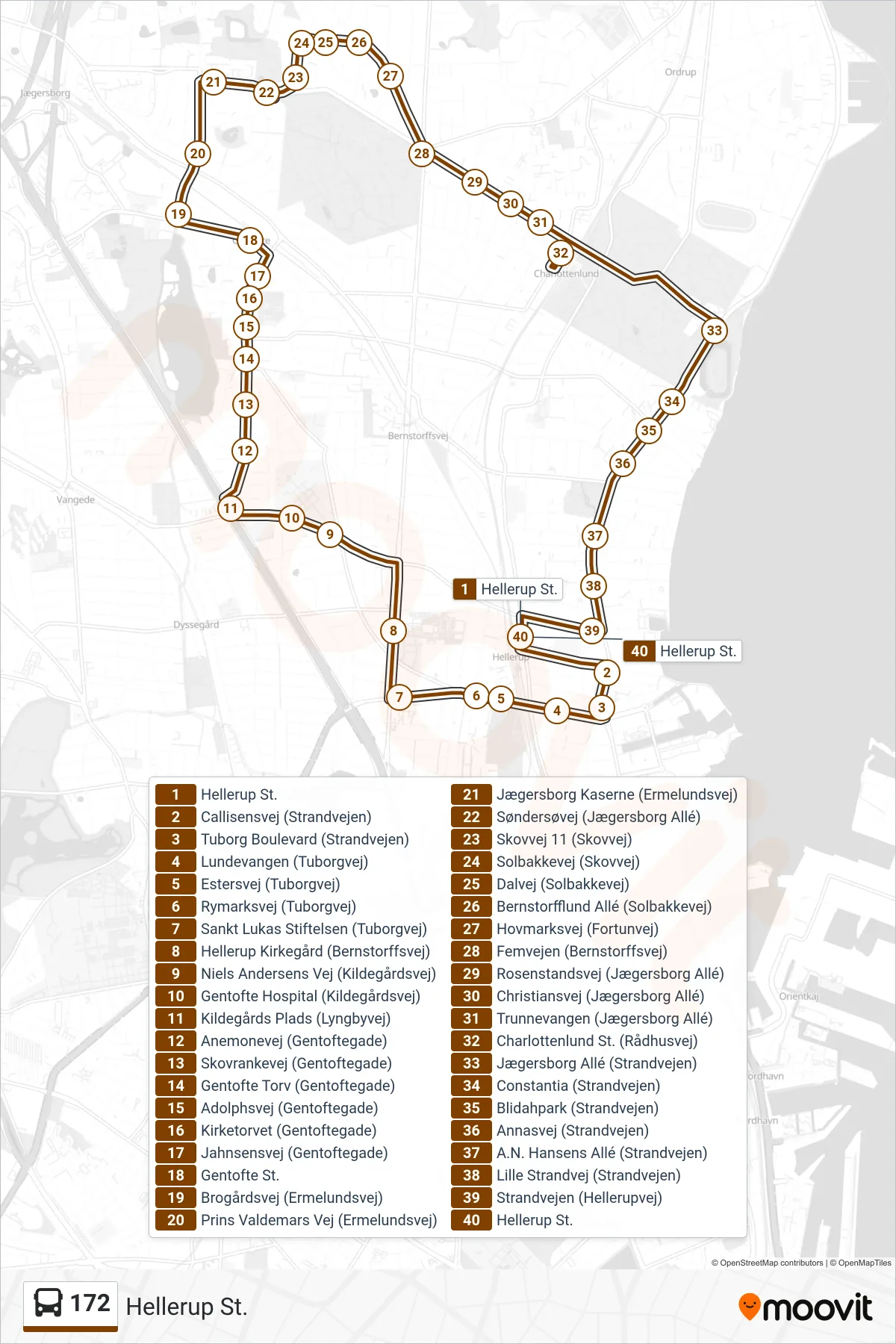
Stops list (172 - Hellerup St.)
- Hellerup St.
- Callisensvej (Strandvejen)
- Tuborg Boulevard (Strandvejen)
- Lundevangen (Tuborgvej)
- Estersvej (Tuborgvej)
- Rymarksvej (Tuborgvej)
- Sankt Lukas Stiftelsen (Tuborgvej)
- Hellerup Kirkegård (Bernstorffsvej)
- Niels Andersens Vej (Kildegårdsvej)
- Gentofte Hospital (Kildegårdsvej)
- Kildegårds Plads (Lyngbyvej)
- Anemonevej (Gentoftegade)
- Skovrankevej (Gentoftegade)
- Gentofte Torv (Gentoftegade)
- Adolphsvej (Gentoftegade)
- Kirketorvet (Gentoftegade)
- Jahnsensvej (Gentoftegade)
- Gentofte St.
- Brogårdsvej (Ermelundsvej)
- Prins Valdemars Vej (Ermelundsvej)
- Jægersborg Kaserne (Ermelundsvej)
- Søndersøvej (Jægersborg Allé)
- Skovvej 11 (Skovvej)
- Solbakkevej (Skovvej)
- Dalvej (Solbakkevej)
- Bernstorfflund Allé (Solbakkevej)
- Hovmarksvej (Fortunvej)
- Femvejen (Bernstorffsvej)
- Rosenstandsvej (Jægersborg Allé)
- Christiansvej (Jægersborg Allé)
- Trunnevangen (Jægersborg Allé)
- Charlottenlund St. (Rådhusvej)
- Jægersborg Allé (Strandvejen)
- Constantia (Strandvejen)
- Blidahpark (Strandvejen)
- Annasvej (Strandvejen)
- A.N. Hansens Allé (Strandvejen)
- Lille Strandvej (Strandvejen)
- Strandvejen (Hellerupvej)
- Hellerup St.