
18 Bus Route Map
View the 18 route map and see all 18 stops along the route. The map of 18 shows where the bus travels and the location of each stop, making it easy to understand the entire route at a glance.
Explore MBTA routes on the map and see where MBTA bus services operate. Use the 18 map to find bus stops and see how the 18 connects different areas along its trip.
All 18 stops on the map are displayed in route order, helping you follow the 18 bus from the first stop to the last.
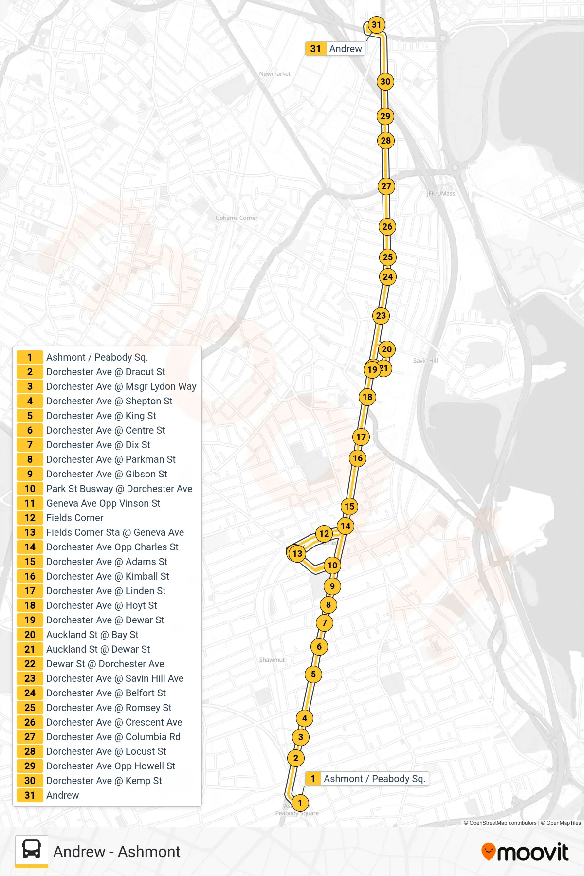
Stops list (18 - Andrew)
- Ashmont / Peabody Sq.
- Dorchester Ave @ Dracut St
- Dorchester Ave @ Msgr Lydon Way
- Dorchester Ave @ Shepton St
- Dorchester Ave @ King St
- Dorchester Ave @ Centre St
- Dorchester Ave @ Dix St
- Dorchester Ave @ Parkman St
- Dorchester Ave @ Gibson St
- Park St Busway @ Dorchester Ave
- Geneva Ave Opp Vinson St
- Fields Corner
- Fields Corner Sta @ Geneva Ave
- Dorchester Ave Opp Charles St
- Dorchester Ave @ Adams St
- Dorchester Ave @ Kimball St
- Dorchester Ave @ Linden St
- Dorchester Ave @ Hoyt St
- Dorchester Ave @ Dewar St
- Auckland St @ Bay St
- Auckland St @ Dewar St
- Dewar St @ Dorchester Ave
- Dorchester Ave @ Savin Hill Ave
- Dorchester Ave @ Belfort St
- Dorchester Ave @ Romsey St
- Dorchester Ave @ Crescent Ave
- Dorchester Ave @ Columbia Rd
- Dorchester Ave @ Locust St
- Dorchester Ave Opp Howell St
- Dorchester Ave @ Kemp St
- Andrew