
18 Bus Route Map
View the 18 route map and see all 18 stops along the route. The map of 18 shows where the bus travels and the location of each stop, making it easy to understand the entire route at a glance.
Explore Kavim routes on the map and see where Kavim bus services operate. Use the 18 map to find bus stops and see how the 18 connects different areas along its trip.
All 18 stops on the map are displayed in route order, helping you follow the 18 bus from the first stop to the last.
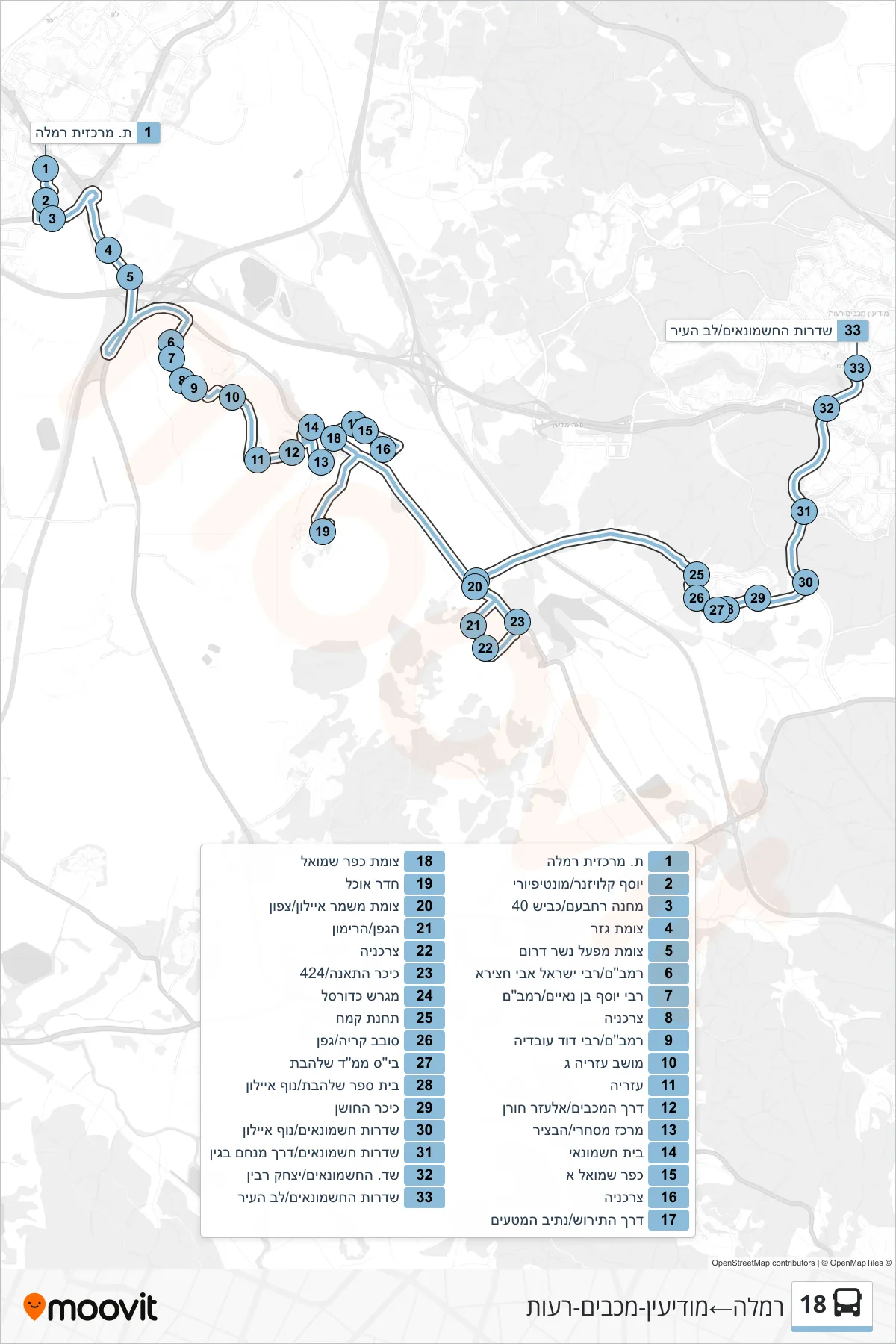
Stops list (18 - Ramla→Modi'in-Maccabim-Re'ut)
- Ramla Central Station
- Yosef Klausner/Montefiore
- Camp Rehavam/Road 40
- Gezer Junction
- Nesher Factory South Junction
- Rambam/Rabbi Israel Abuhatzeira
- Rabbi Yosef Ben Naim/Rambam
- Grocery Store
- Rambam/Rabbi David Ovadia
- Moshav Azaria C
- Azarya
- Derech HaMaccabim/Elazar Horan
- Commercial Center/HaBatzir
- Beit Hashmonai
- Kfar Shmuel A
- Grocery Store
- HaTirosh Road/Nativ HaMataim
- Kfar Shmuel Junction
- Dining Hall
- Mishmar Ayalon Junction/North
- HaGefen/HaRimon
- Grocery Store
- Fig Square/424
- Basketball Court
- Flour Station
- Sovev Kirya/Gefen
- Shalhevet Religious School
- Shalhevet School/Nof Ayalon
- HaHoshen Square
- Hashmonaim Boulevard/Nof Ayalon
- Hashmonaim Boulevard/Menachem Begin Road
- Hashmonaim Blvd/Yitzhak Rabin
- Hashmonaim Blvd/Lev HaIr