
18 Bus Route Map
View the 18 route map and see all 18 stops along the route. The map of 18 shows where the bus travels and the location of each stop, making it easy to understand the entire route at a glance.
Explore Autobuses routes on the map and see where Autobuses bus services operate. Use the 18 map to find bus stops and see how the 18 connects different areas along its trip.
All 18 stops on the map are displayed in route order, helping you follow the 18 bus from the first stop to the last.
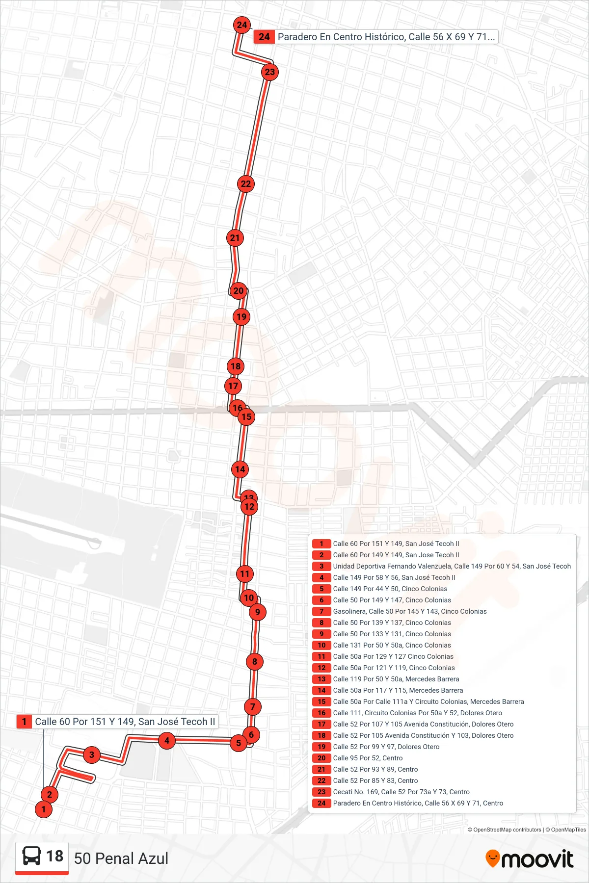
Stops list (18 - 50 Penal Azul)
- Calle 60 Por 151 Y 149, San José Tecoh II
- Calle 60 Por 149 Y 149, San Jose Tecoh II
- Unidad Deportiva Fernando Valenzuela, Calle 149 Por 60 Y 54, San José Tecoh
- Calle 149 Por 58 Y 56, San José Tecoh II
- Calle 149 Por 44 Y 50, Cinco Colonias
- Calle 50 Por 149 Y 147, Cinco Colonias
- Gasolinera, Calle 50 Por 145 Y 143, Cinco Colonias
- Calle 50 Por 139 Y 137, Cinco Colonias
- Calle 50 Por 133 Y 131, Cinco Colonias
- Calle 131 Por 50 Y 50a, Cinco Colonias
- Calle 50a Por 129 Y 127 Cinco Colonias
- Calle 50a Por 121 Y 119, Cinco Colonias
- Calle 119 Por 50 Y 50a, Mercedes Barrera
- Calle 50a Por 117 Y 115, Mercedes Barrera
- Calle 50a Por Calle 111a Y Circuito Colonias, Mercedes Barrera
- Calle 111, Circuito Colonias Por 50a Y 52, Dolores Otero
- Calle 52 Por 107 Y 105 Avenida Constitución, Dolores Otero
- Calle 52 Por 105 Avenida Constitución Y 103, Dolores Otero
- Calle 52 Por 99 Y 97, Dolores Otero
- Calle 95 Por 52, Centro
- Calle 52 Por 93 Y 89, Centro
- Calle 52 Por 85 Y 83, Centro
- Cecati No. 169, Calle 52 Por 73a Y 73, Centro
- Paradero En Centro Histórico, Calle 56 X 69 Y 71, Centro