
18 Bus Route Map
View the 18 route map and see all 18 stops along the route. The map of 18 shows where the bus travels and the location of each stop, making it easy to understand the entire route at a glance.
Explore Autobuses routes on the map and see where Autobuses bus services operate. Use the 18 map to find bus stops and see how the 18 connects different areas along its trip.
All 18 stops on the map are displayed in route order, helping you follow the 18 bus from the first stop to the last.
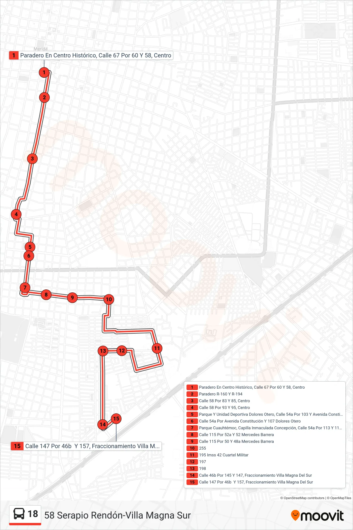
Stops list (18 - 58 Serapio Rendón-Villa Magna Sur)
- Paradero En Centro Histórico, Calle 67 Por 60 Y 58, Centro
- Paradero R-160 Y R-194
- Calle 58 Por 83 Y 85, Centro
- Calle 58 Por 93 Y 95, Centro
- Parque Y Unidad Deportiva Dolores Otero, Calle 54a Por 103 Y Avenida Constitución, Dolores Otero
- Calle 54a Por Avenida Constitución Y 107 Dolores Otero
- Parque Cuauhtémoc, Capilla Inmaculada Concepción, Calle 54a Por 113 Y 115, Mercedes Barrera
- Calle 115 Por 52a Y 52 Mercedes Barrera
- Calle 115 Por 50 Y 48a Mercedes Barrera
- 255
- 195 Imss 42 Cuartel Militar
- 197
- 198
- Calle 46b Por 145 Y 147, Fraccionamiento Villa Magna Del Sur
- Calle 147 Por 46b Y 157, Fraccionamiento Villa Magna Del Sur