
18 Bus Route Map
View the 18 route map and see all 18 stops along the route. The map of 18 shows where the bus travels and the location of each stop, making it easy to understand the entire route at a glance.
Explore SEPTA routes on the map and see where SEPTA bus services operate. Use the 18 map to find bus stops and see how the 18 connects different areas along its trip.
All 18 stops on the map are displayed in route order, helping you follow the 18 bus from the first stop to the last.
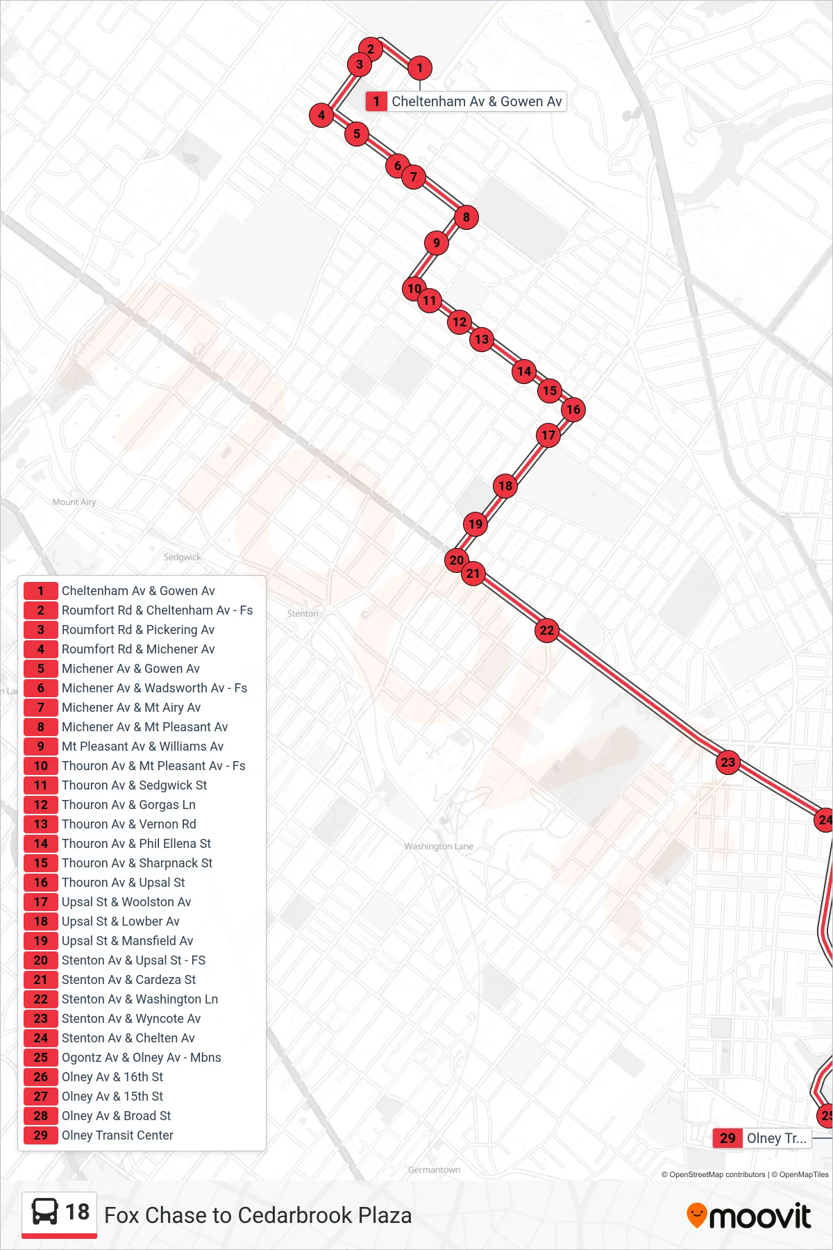
Stops list (18 - Express Olney Transit Center)
- Cheltenham Av & Gowen Av
- Roumfort Rd & Cheltenham Av - Fs
- Roumfort Rd & Pickering Av
- Roumfort Rd & Michener Av
- Michener Av & Gowen Av
- Michener Av & Wadsworth Av - Fs
- Michener Av & Mt Airy Av
- Michener Av & Mt Pleasant Av
- Mt Pleasant Av & Williams Av
- Thouron Av & Mt Pleasant Av - Fs
- Thouron Av & Sedgwick St
- Thouron Av & Gorgas Ln
- Thouron Av & Vernon Rd
- Thouron Av & Phil Ellena St
- Thouron Av & Sharpnack St
- Thouron Av & Upsal St
- Upsal St & Woolston Av
- Upsal St & Lowber Av
- Upsal St & Mansfield Av
- Stenton Av & Upsal St - FS
- Stenton Av & Cardeza St
- Stenton Av & Washington Ln
- Stenton Av & Wyncote Av
- Stenton Av & Chelten Av
- Ogontz Av & Olney Av - Mbns
- Olney Av & 16th St
- Olney Av & 15th St
- Olney Av & Broad St
- Olney Transit Center