
18 Bus Route Map
View the 18 route map and see all 18 stops along the route. The map of 18 shows where the bus travels and the location of each stop, making it easy to understand the entire route at a glance.
Explore Stadtwerke Münster GmbH routes on the map and see where Stadtwerke Münster GmbH bus services operate. Use the 18 map to find bus stops and see how the 18 connects different areas along its trip.
All 18 stops on the map are displayed in route order, helping you follow the 18 bus from the first stop to the last.
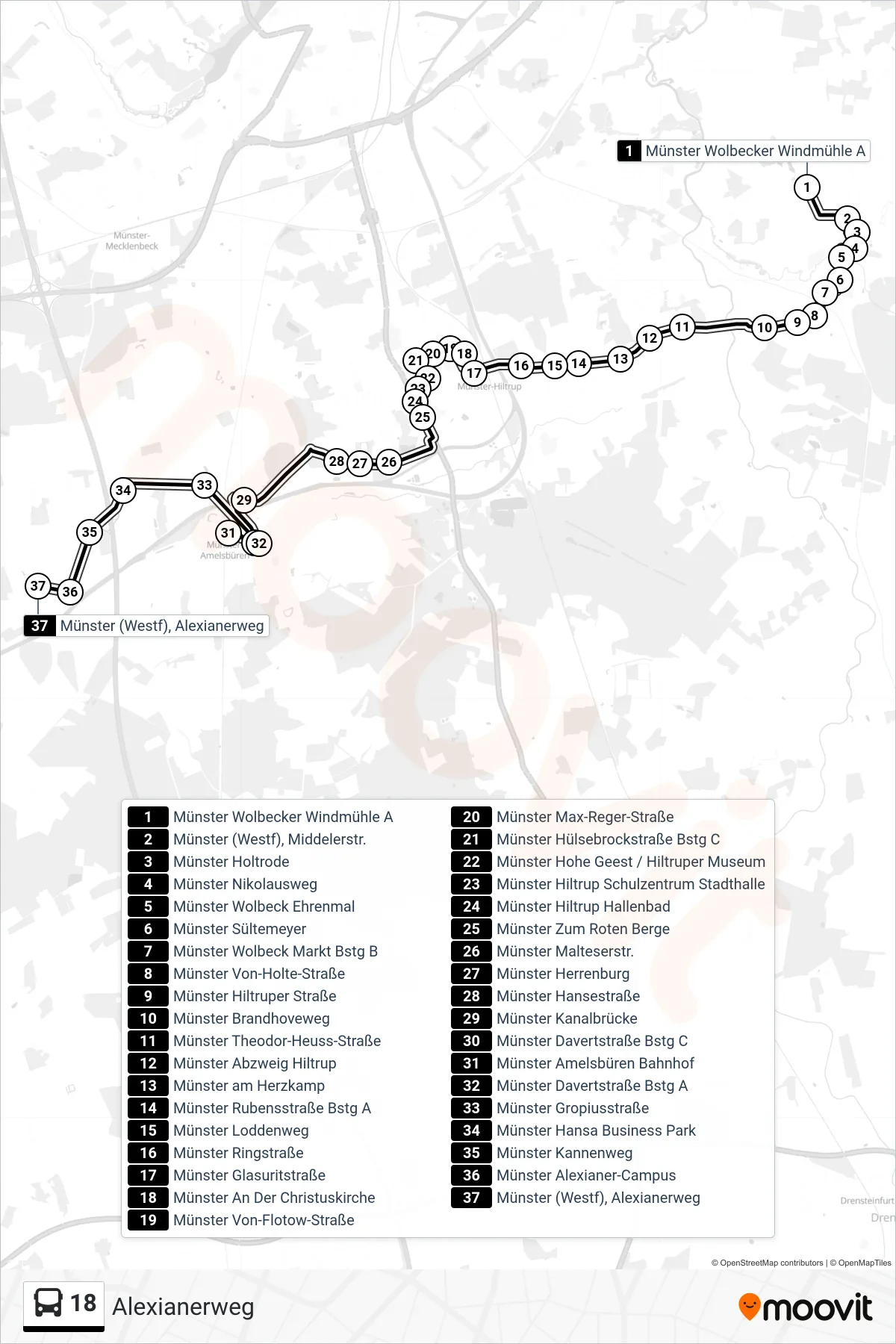
Stops list (18 - Alexianerweg)
- Münster Wolbecker Windmühle A
- Münster (Westf), Middelerstr.
- Münster Holtrode
- Münster Nikolausweg
- Münster Wolbeck Ehrenmal
- Münster Sültemeyer
- Münster Wolbeck Markt Bstg B
- Münster Von-Holte-Straße
- Münster Hiltruper Straße
- Münster Brandhoveweg
- Münster Theodor-Heuss-Straße
- Münster Abzweig Hiltrup
- Münster am Herzkamp
- Münster Rubensstraße Bstg A
- Münster Loddenweg
- Münster Ringstraße
- Münster Glasuritstraße
- Münster An Der Christuskirche
- Münster Von-Flotow-Straße
- Münster Max-Reger-Straße
- Münster Hülsebrockstraße Bstg C
- Münster Hohe Geest / Hiltruper Museum
- Münster Hiltrup Schulzentrum Stadthalle
- Münster Hiltrup Hallenbad
- Münster Zum Roten Berge
- Münster Malteserstr.
- Münster Herrenburg
- Münster Hansestraße
- Münster Kanalbrücke
- Münster Davertstraße Bstg C
- Münster Amelsbüren Bahnhof
- Münster Davertstraße Bstg A
- Münster Gropiusstraße
- Münster Hansa Business Park
- Münster Kannenweg
- Münster Alexianer-Campus
- Münster (Westf), Alexianerweg