
18 Bus Route Map
View the 18 route map and see all 18 stops along the route. The map of 18 shows where the bus travels and the location of each stop, making it easy to understand the entire route at a glance.
Explore City Transport AD routes on the map and see where City Transport AD bus services operate. Use the 18 map to find bus stops and see how the 18 connects different areas along its trip.
All 18 stops on the map are displayed in route order, helping you follow the 18 bus from the first stop to the last.
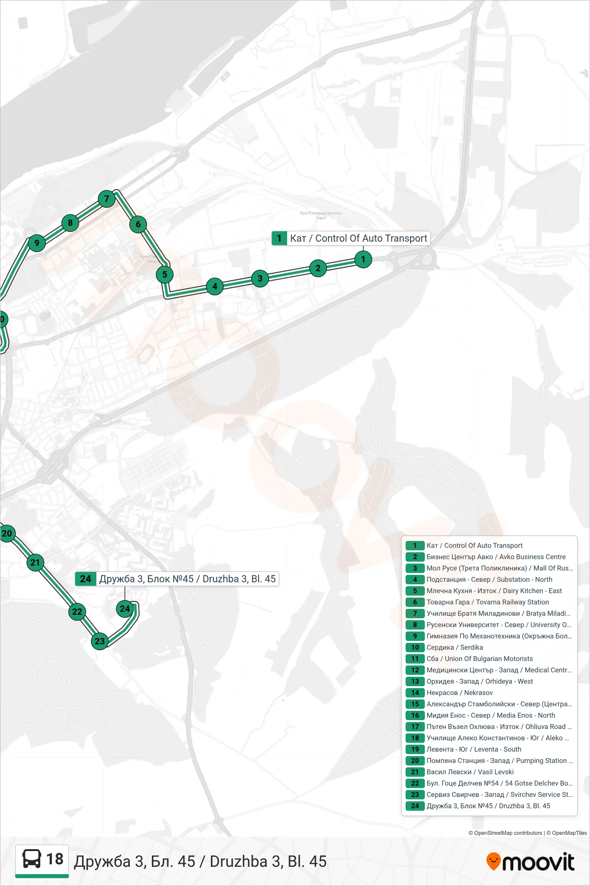
Stops list (18 - Druzhba 3, Block 45)
- Control of Auto Transport
- Avko Business Centre
- Mall of Ruse (3rd Polyclinic)
- Substation - North
- Dairy Kitchen - East
- Tovarna Railway Station
- Bratya Miladinovi Primary School
- University Of Ruse - North
- High School Of Mechanical Engineering (District Hospital)
- Serdika
- Union of Bulgarian Motorists
- Medical Centre - West
- Orhideya - West
- Nekrasov
- Alexander Stamboliyski - North (Central Railway Station)
- Media Enos - North
- Ohliuva Road Junction - East
- Aleko Konstantinov School - South
- Leventa - South
- Pumping Station - West
- Vasil Levski
- 54 Gotse Delchev Boulevard
- Svirchev Service Station - West
- Druzhba 3, Block 45