
18 Bus Route Map
View the 18 route map and see all 18 stops along the route. The map of 18 shows where the bus travels and the location of each stop, making it easy to understand the entire route at a glance.
Explore Omnibus Groß GmbH routes on the map and see where Omnibus Groß GmbH bus services operate. Use the 18 map to find bus stops and see how the 18 connects different areas along its trip.
All 18 stops on the map are displayed in route order, helping you follow the 18 bus from the first stop to the last.
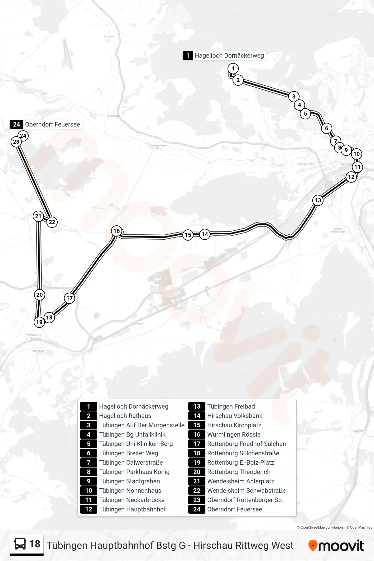
Stops list (18 - Oberndorf Feuersee)
- Hagelloch Dornäckerweg
- Hagelloch Rathaus
- Tübingen Auf Der Morgenstelle
- Tübingen Bg Unfallklinik
- Tübingen Uni-Kliniken Berg
- Tübingen Breiter Weg
- Tübingen Calwerstraße
- Tübingen Parkhaus König
- Tübingen Stadtgraben
- Tübingen Nonnenhaus
- Tübingen Neckarbrücke
- Tübingen Hauptbahnhof
- Tübingen Freibad
- Hirschau Volksbank
- Hirschau Kirchplatz
- Wurmlingen Rössle
- Rottenburg Friedhof Sülchen
- Rottenburg Sülchenstraße
- Rottenburg E.-Bolz-Platz
- Rottenburg Theoderich
- Wendelsheim Adlerplatz
- Wendelsheim Schwabstraße
- Oberndorf Rottenburger Str.
- Oberndorf Feuersee
Change direction
- Route Map - 18 - Hirschau Rittweg West
- Route Map - 18 - Hirschau Kirchplatz
- Route Map - 18 - Tübingen Hauptbahnhof
- Route Map - 18 - Pfäffingen Bahnhof
- Route Map - 18 - Hagelloch Dornäckerweg
- Route Map - 18 - Rottenburg E.-Bolz-Platz
- Route Map - 18 - Tübingen Bg Unfallklinik
- Route Map - 18 - Tübingen Hauptbahnhof
- Route Map - 18 - Rottenburg Kreuzerfeldschule
- Route Map - 18 - Rottenburg E.-Bolz-Platz