
181 Bus Route Map
View the 181 route map and see all 181 stops along the route. The map of 181 shows where the bus travels and the location of each stop, making it easy to understand the entire route at a glance.
Explore DB Regio Bus Mitte routes on the map and see where DB Regio Bus Mitte bus services operate. Use the 181 map to find bus stops and see how the 181 connects different areas along its trip.
All 181 stops on the map are displayed in route order, helping you follow the 181 bus from the first stop to the last.
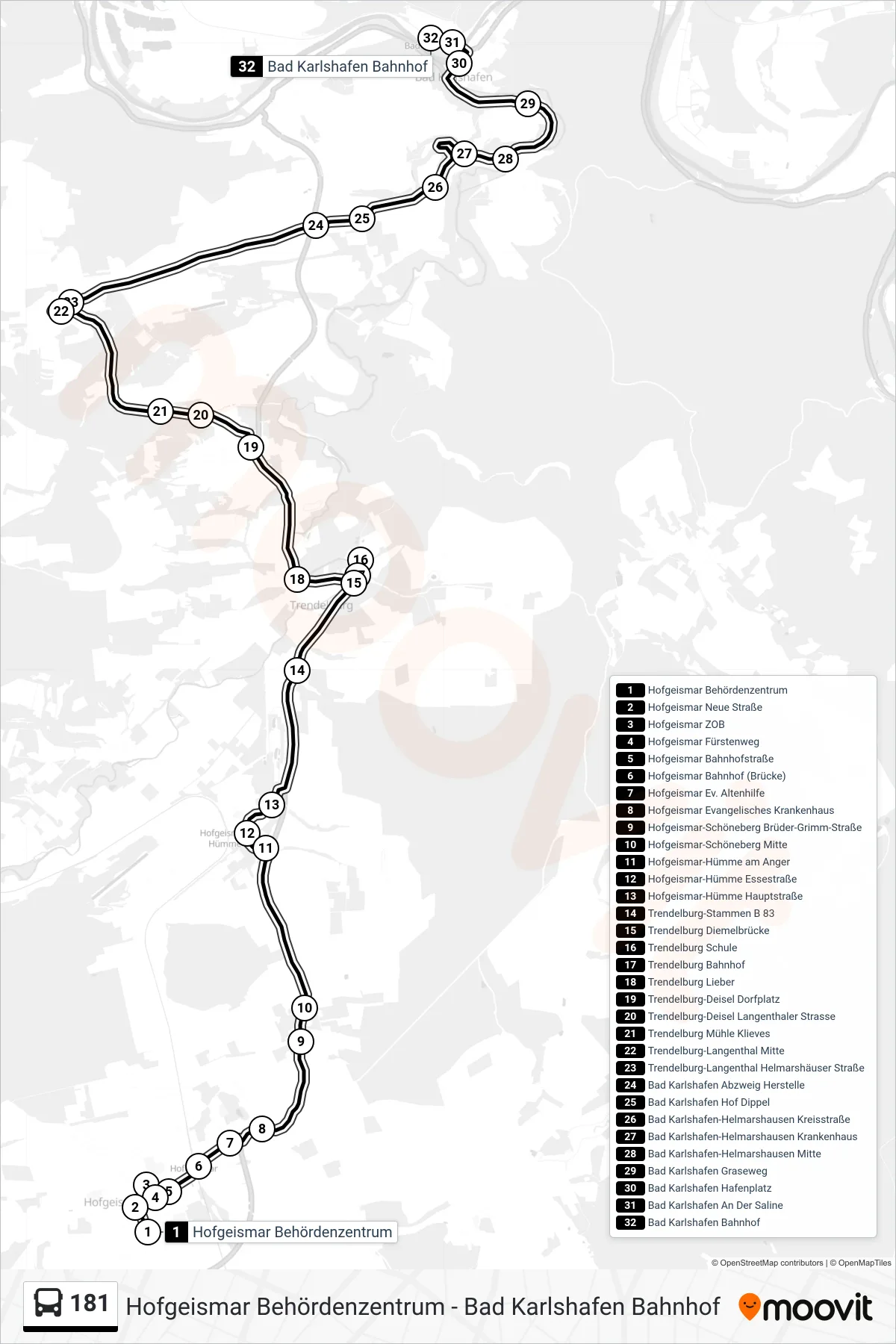
Stops list (181 - Bad Karlshafen Bf.)
- Hofgeismar Behördenzentrum
- Hofgeismar Neue Straße
- Hofgeismar ZOB
- Hofgeismar Fürstenweg
- Hofgeismar Bahnhofstraße
- Hofgeismar Bahnhof (Brücke)
- Hofgeismar Ev. Altenhilfe
- Hofgeismar Evangelisches Krankenhaus
- Hofgeismar-Schöneberg Brüder-Grimm-Straße
- Hofgeismar-Schöneberg Mitte
- Hofgeismar-Hümme am Anger
- Hofgeismar-Hümme Essestraße
- Hofgeismar-Hümme Hauptstraße
- Trendelburg-Stammen B 83
- Trendelburg Diemelbrücke
- Trendelburg Schule
- Trendelburg Bahnhof
- Trendelburg Lieber
- Trendelburg-Deisel Dorfplatz
- Trendelburg-Deisel Langenthaler Strasse
- Trendelburg Mühle Klieves
- Trendelburg-Langenthal Mitte
- Trendelburg-Langenthal Helmarshäuser Straße
- Bad Karlshafen Abzweig Herstelle
- Bad Karlshafen Hof Dippel
- Bad Karlshafen-Helmarshausen Kreisstraße
- Bad Karlshafen-Helmarshausen Krankenhaus
- Bad Karlshafen-Helmarshausen Mitte
- Bad Karlshafen Graseweg
- Bad Karlshafen Hafenplatz
- Bad Karlshafen An Der Saline
- Bad Karlshafen Bahnhof