
18B Bus Route Map
View the 18B route map and see all 18B stops along the route. The map of 18B shows where the bus travels and the location of each stop, making it easy to understand the entire route at a glance.
Explore De Lijn routes on the map and see where De Lijn bus services operate. Use the 18B map to find bus stops and see how the 18B connects different areas along its trip.
All 18B stops on the map are displayed in route order, helping you follow the 18B bus from the first stop to the last.
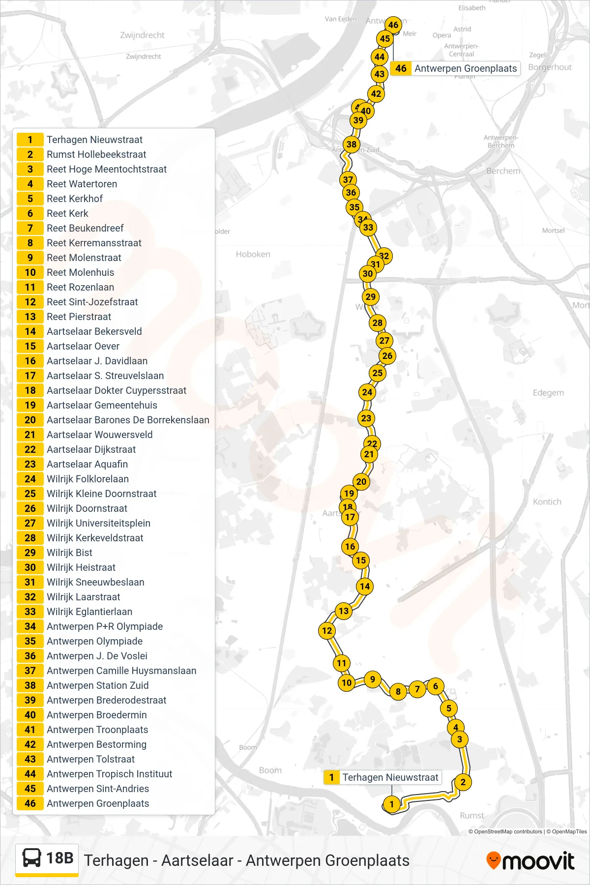
Stops list (18B - Antwerp Green Square)
- Terhagen New Street
- Rumst Hollebeek Street
- Reet High Meentocht Street
- Reet Water Tower
- Reet Cemetery
- Reet Church
- Reet Beech Avenue
- Reet Kerremans Street
- Reet Mill Street
- Reet Mill House
- Reet Rose Avenue
- Reet Saint Joseph Street
- Reet Pier Street
- Aartselaar Bekers Field
- Aartselaar Riverbank
- Aartselaar J. David Avenue
- Aartselaar S. Streuvelslaan
- Aartselaar Doctor Cuypers Street
- Aartselaar Town Hall
- Aartselaar Baroness De Borrekens Avenue
- Aartselaar Wouwersveld
- Dijkstraat - Aartselaar
- Aartselaar Aquafin
- Wilrijk Folklore Avenue
- Wilrijk Small Thorn Street
- Wilrijk Thorn Street
- Wilrijk University Square
- Wilrijk Kirkfield Street
- Wilrijk Bist
- Wilrijk Hei Street
- Wilrijk Snow Berry Avenue
- Wilrijk Laar Street
- Wilrijk Eglantier Avenue
- Antwerp P+R Olympiad
- Antwerp Olympics
- Antwerp J. De Voslei
- Antwerp Camille Huysmans Avenue
- Antwerp South Station
- Antwerp Brederode Street
- Antwerp Brotherhood
- Antwerp Throne Square
- Antwerp Assault
- Antwerp Tol Street
- Antwerp Tropical Institute
- Antwerp Saint Andrews
- Antwerp Green Square