
19 Bus Route Map
View the 19 route map and see all 19 stops along the route. The map of 19 shows where the bus travels and the location of each stop, making it easy to understand the entire route at a glance.
Explore Cottbusverkehr routes on the map and see where Cottbusverkehr bus services operate. Use the 19 map to find bus stops and see how the 19 connects different areas along its trip.
All 19 stops on the map are displayed in route order, helping you follow the 19 bus from the first stop to the last.
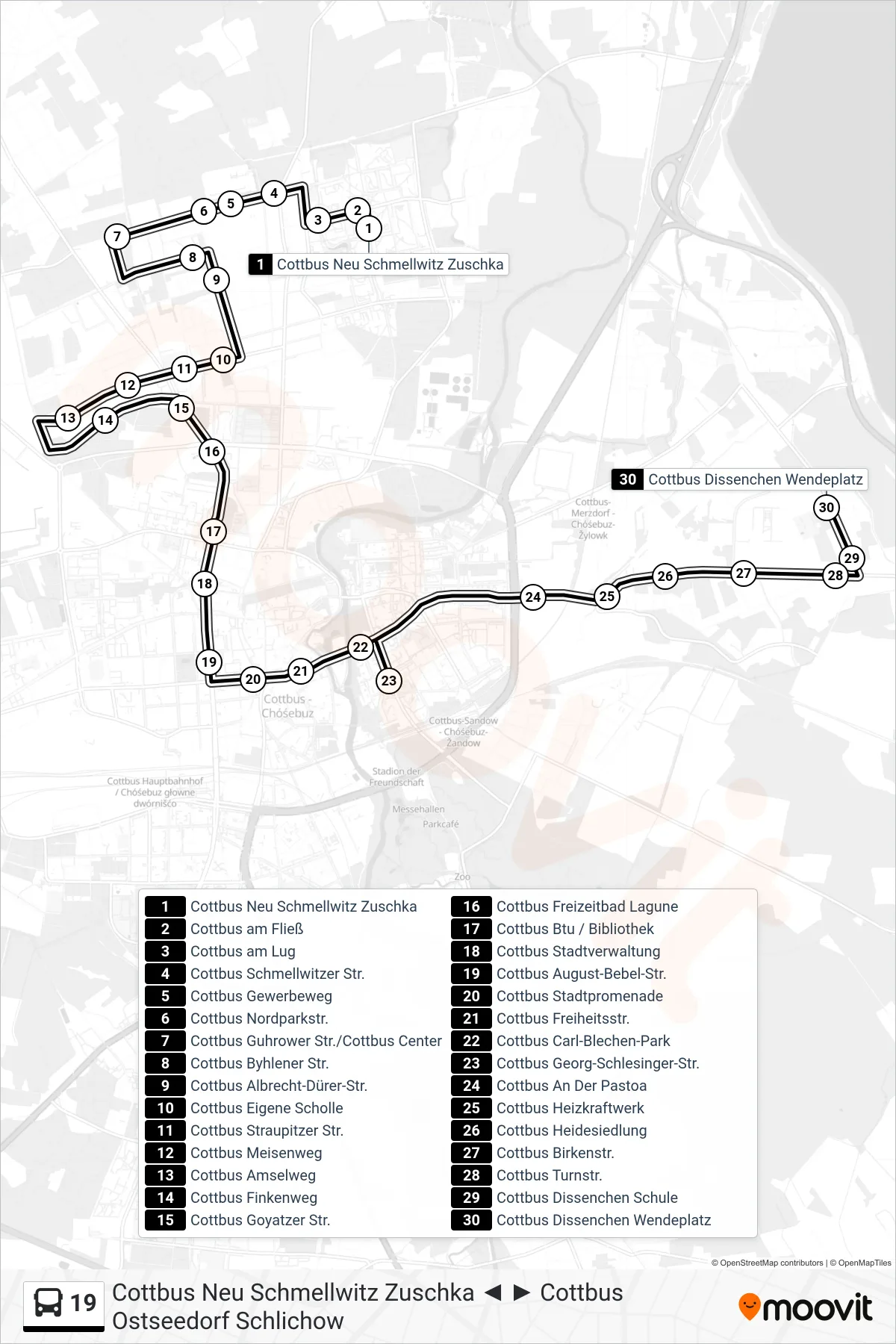
Stops list (19 - Cottbus Dissenchen Wendeplatz)
- Cottbus Neu Schmellwitz Zuschka
- Cottbus am Fließ
- Cottbus am Lug
- Cottbus Schmellwitzer Str.
- Cottbus Gewerbeweg
- Cottbus Nordparkstr.
- Cottbus Guhrower Str./Cottbus Center
- Cottbus Byhlener Str.
- Cottbus Albrecht-Dürer-Str.
- Cottbus Eigene Scholle
- Cottbus Straupitzer Str.
- Cottbus Meisenweg
- Cottbus Amselweg
- Cottbus Finkenweg
- Cottbus Goyatzer Str.
- Cottbus Freizeitbad Lagune
- Cottbus Btu / Bibliothek
- Cottbus Stadtverwaltung
- Cottbus August-Bebel-Str.
- Cottbus Stadtpromenade
- Cottbus Freiheitsstr.
- Cottbus Carl-Blechen-Park
- Cottbus Georg-Schlesinger-Str.
- Cottbus An Der Pastoa
- Cottbus Heizkraftwerk
- Cottbus Heidesiedlung
- Cottbus Birkenstr.
- Cottbus Turnstr.
- Cottbus Dissenchen Schule
- Cottbus Dissenchen Wendeplatz