
19 Bus Route Map
View the 19 route map and see all 19 stops along the route. The map of 19 shows where the bus travels and the location of each stop, making it easy to understand the entire route at a glance.
Explore Bus Átha Cliath – Dublin Bus routes on the map and see where Bus Átha Cliath – Dublin Bus bus services operate. Use the 19 map to find bus stops and see how the 19 connects different areas along its trip.
All 19 stops on the map are displayed in route order, helping you follow the 19 bus from the first stop to the last.
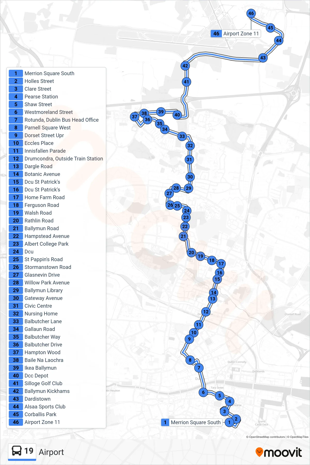
Stops list (19 - Airport)
- Merrion Square South
- Holles Street
- Clare Street
- Pearse Station
- Shaw Street
- Westmoreland Street
- Rotunda, Dublin Bus Head Office
- Parnell Square West
- Dorset Street Upr
- Eccles Place
- Innisfallen Parade
- Drumcondra, Outside Train Station
- Dargle Road
- Botanic Avenue
- Dcu St Patrick's
- Dcu St Patrick's
- Home Farm Road
- Ferguson Road
- Walsh Road
- Rathlin Road
- Ballymun Road
- Hampstead Avenue
- Albert College Park
- Dcu
- St Pappin's Road
- Stormanstown Road
- Glasnevin Drive
- Willow Park Avenue
- Ballymun Library
- Gateway Avenue
- Civic Centre
- Nursing Home
- Balbutcher Lane
- Gallaun Road
- Balbutcher Way
- Balbutcher Drive
- Hampton Wood
- Baile Na Laochra
- Ikea Ballymun
- Dcc Depot
- Silloge Golf Club
- Ballymun Kickhams
- Dardistown
- Alsaa Sports Club
- Corballis Park
- Airport Zone 11