
19 Bus Route Map
View the 19 route map and see all 19 stops along the route. The map of 19 shows where the bus travels and the location of each stop, making it easy to understand the entire route at a glance.
Explore Niederrheinische VKB routes on the map and see where Niederrheinische VKB bus services operate. Use the 19 map to find bus stops and see how the 19 connects different areas along its trip.
All 19 stops on the map are displayed in route order, helping you follow the 19 bus from the first stop to the last.
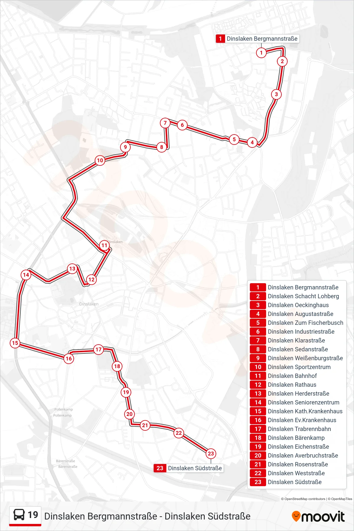
Stops list (19 - Dinslaken Südstraße)
- Dinslaken Bergmannstraße
- Dinslaken Schacht Lohberg
- Dinslaken Oeckinghaus
- Dinslaken Augustastraße
- Dinslaken Zum Fischerbusch
- Dinslaken Industriestraße
- Dinslaken Klarastraße
- Dinslaken Sedanstraße
- Dinslaken Weißenburgstraße
- Dinslaken Sportzentrum
- Dinslaken Bahnhof
- Dinslaken Rathaus
- Dinslaken Herderstraße
- Dinslaken Seniorenzentrum
- Dinslaken Kath.Krankenhaus
- Dinslaken Ev.Krankenhaus
- Dinslaken Trabrennbahn
- Dinslaken Bärenkamp
- Dinslaken Eichenstraße
- Dinslaken Averbruchstraße
- Dinslaken Rosenstraße
- Dinslaken Weststraße
- Dinslaken Südstraße