
19 Bus Route Map
View the 19 route map and see all 19 stops along the route. The map of 19 shows where the bus travels and the location of each stop, making it easy to understand the entire route at a glance.
Explore Stadtwerke Münster GmbH routes on the map and see where Stadtwerke Münster GmbH bus services operate. Use the 19 map to find bus stops and see how the 19 connects different areas along its trip.
All 19 stops on the map are displayed in route order, helping you follow the 19 bus from the first stop to the last.
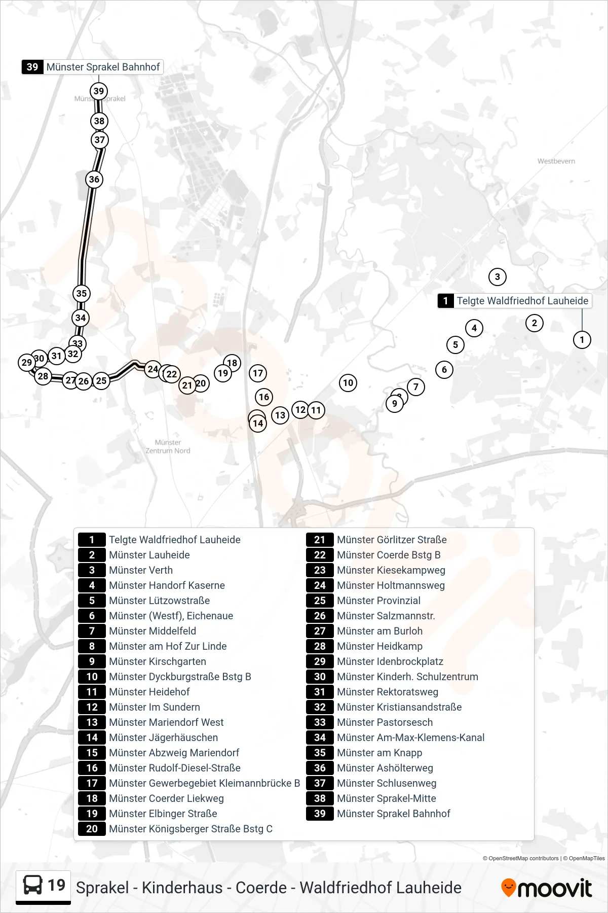
Stops list (19 - Sprakel)
- Telgte Waldfriedhof Lauheide
- Münster Lauheide
- Münster Verth
- Münster Handorf Kaserne
- Münster Lützowstraße
- Münster (Westf), Eichenaue
- Münster Middelfeld
- Münster am Hof Zur Linde
- Münster Kirschgarten
- Münster Dyckburgstraße Bstg B
- Münster Heidehof
- Münster Im Sundern
- Münster Mariendorf West
- Münster Jägerhäuschen
- Münster Abzweig Mariendorf
- Münster Rudolf-Diesel-Straße
- Münster Gewerbegebiet Kleimannbrücke B
- Münster Coerder Liekweg
- Münster Elbinger Straße
- Münster Königsberger Straße Bstg C
- Münster Görlitzer Straße
- Münster Coerde Bstg B
- Münster Kiesekampweg
- Münster Holtmannsweg
- Münster Provinzial
- Münster Salzmannstr.
- Münster am Burloh
- Münster Heidkamp
- Münster Idenbrockplatz
- Münster Kinderh. Schulzentrum
- Münster Rektoratsweg
- Münster Kristiansandstraße
- Münster Pastorsesch
- Münster Am-Max-Klemens-Kanal
- Münster am Knapp
- Münster Ashölterweg
- Münster Schlusenweg
- Münster Sprakel-Mitte
- Münster Sprakel Bahnhof