
19 Bus Route Map
View the 19 route map and see all 19 stops along the route. The map of 19 shows where the bus travels and the location of each stop, making it easy to understand the entire route at a glance.
Explore AC Transit routes on the map and see where AC Transit bus services operate. Use the 19 map to find bus stops and see how the 19 connects different areas along its trip.
All 19 stops on the map are displayed in route order, helping you follow the 19 bus from the first stop to the last.
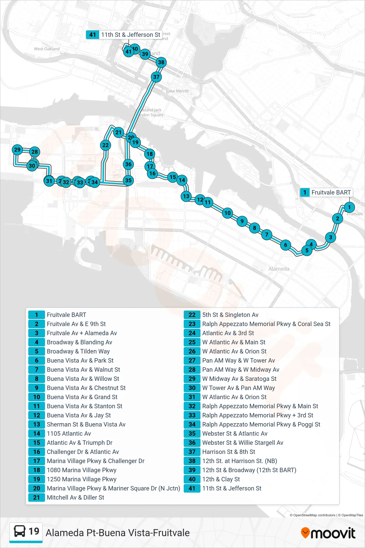
Stops list (19 - Downtown Oakland)
- Fruitvale BART
- Fruitvale Av & E 9th St
- Fruitvale Av + Alameda Av
- Broadway & Blanding Av
- Broadway & Tilden Way
- Buena Vista Av & Park St
- Buena Vista Av & Walnut St
- Buena Vista Av & Willow St
- Buena Vista Av & Chestnut St
- Buena Vista Av & Grand St
- Buena Vista Av & Stanton St
- Buena Vista Av & Jay St
- Sherman St & Buena Vista Av
- 1105 Atlantic Av
- Atlantic Av & Triumph Dr
- Challenger Dr & Atlantic Av
- Marina Village Pkwy & Challenger Dr
- 1080 Marina Village Pkwy
- 1250 Marina Village Pkwy
- Marina Village Pkwy & Mariner Square Dr (N Jctn)
- Mitchell Av & Diller St
- 5th St & Singleton Av
- Ralph Appezzato Memorial Pkwy & Coral Sea St
- Atlantic Av & 3rd St
- W Atlantic Av & Main St
- W Atlantic Av & Orion St
- Pan AM Way & W Tower Av
- Pan AM Way & W Midway Av
- W Midway Av & Saratoga St
- W Tower Av & Pan AM Way
- W Atlantic Av & Orion St
- Ralph Appezzato Memorial Pkwy & Main St
- Ralph Appezzato Memorial Pkwy + 3rd St
- Ralph Appezzato Memorial Pkwy & Poggi St
- Webster St & Atlantic Av
- Webster St & Willie Stargell Av
- Harrison St & 8th St
- 12th St. at Harrison St. (NB)
- 12th St & Broadway (12th St BART)
- 12th & Clay St
- 11th St & Jefferson St