
19 Bus Route Map
View the 19 route map and see all 19 stops along the route. The map of 19 shows where the bus travels and the location of each stop, making it easy to understand the entire route at a glance.
Explore County Connection routes on the map and see where County Connection bus services operate. Use the 19 map to find bus stops and see how the 19 connects different areas along its trip.
All 19 stops on the map are displayed in route order, helping you follow the 19 bus from the first stop to the last.
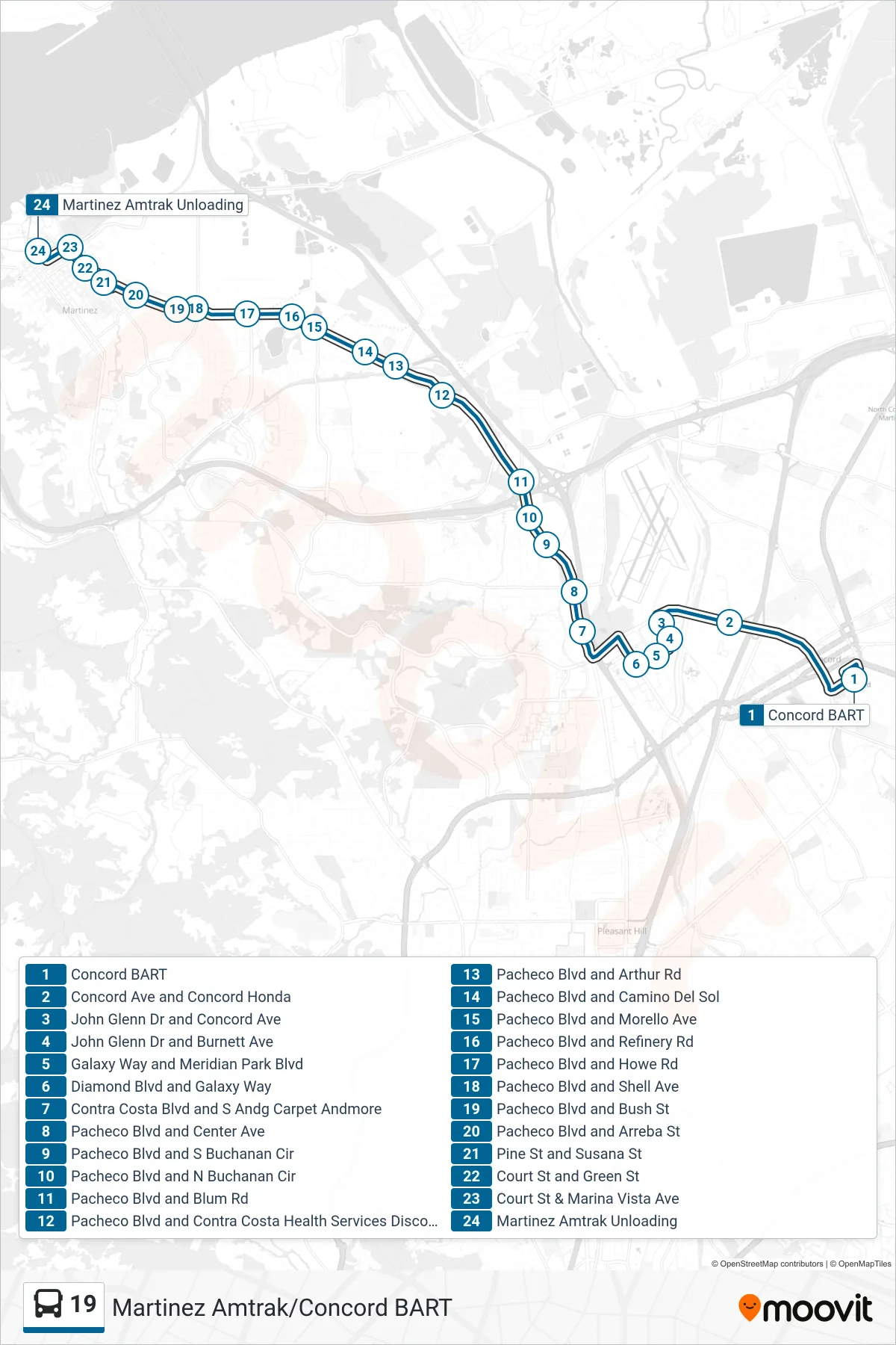
Stops list (19 - Martinez Amtrak via Pacheco Blvd.)
- Concord BART
- Concord Ave and Concord Honda
- John Glenn Dr and Concord Ave
- John Glenn Dr and Burnett Ave
- Galaxy Way and Meridian Park Blvd
- Diamond Blvd and Galaxy Way
- Contra Costa Blvd and S Andg Carpet Andmore
- Pacheco Blvd and Center Ave
- Pacheco Blvd and S Buchanan Cir
- Pacheco Blvd and N Buchanan Cir
- Pacheco Blvd and Blum Rd
- Pacheco Blvd and Contra Costa Health Services Discovery House
- Pacheco Blvd and Arthur Rd
- Pacheco Blvd and Camino Del Sol
- Pacheco Blvd and Morello Ave
- Pacheco Blvd and Refinery Rd
- Pacheco Blvd and Howe Rd
- Pacheco Blvd and Shell Ave
- Pacheco Blvd and Bush St
- Pacheco Blvd and Arreba St
- Pine St and Susana St
- Court St and Green St
- Court St & Marina Vista Ave
- Martinez Amtrak Unloading