
19 Bus Route Map
View the 19 route map and see all 19 stops along the route. The map of 19 shows where the bus travels and the location of each stop, making it easy to understand the entire route at a glance.
Explore Montgomery County Ride On routes on the map and see where Montgomery County Ride On bus services operate. Use the 19 map to find bus stops and see how the 19 connects different areas along its trip.
All 19 stops on the map are displayed in route order, helping you follow the 19 bus from the first stop to the last.
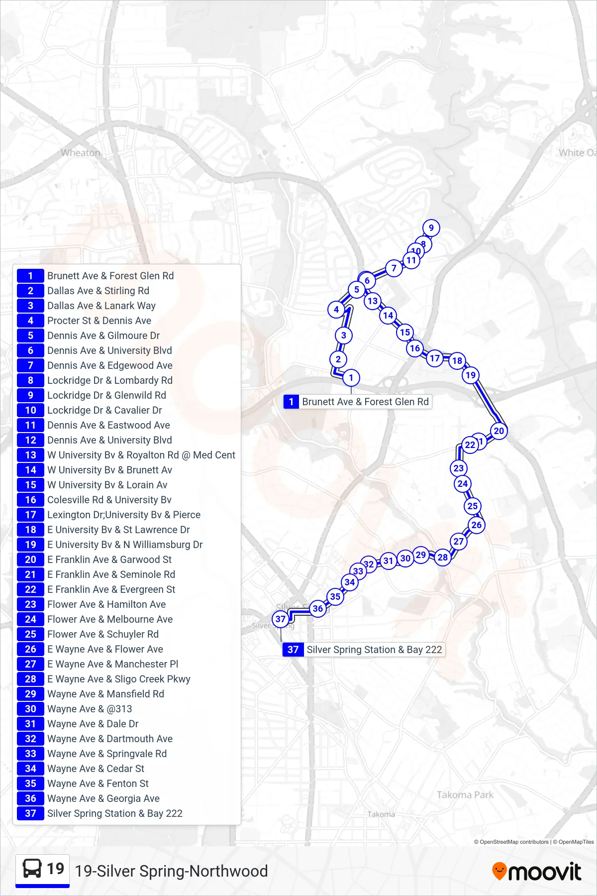
Stops list (19 - Silver Spring)
- Brunett Ave & Forest Glen Rd
- Dallas Ave & Stirling Rd
- Dallas Ave & Lanark Way
- Procter St & Dennis Ave
- Dennis Ave & Gilmoure Dr
- Dennis Ave & University Blvd
- Dennis Ave & Edgewood Ave
- Lockridge Dr & Lombardy Rd
- Lockridge Dr & Glenwild Rd
- Lockridge Dr & Cavalier Dr
- Dennis Ave & Eastwood Ave
- Dennis Ave & University Blvd
- W University Bv & Royalton Rd @ Med Cent
- W University Bv & Brunett Av
- W University Bv & Lorain Av
- Colesville Rd & University Bv
- Lexington Dr;University Bv & Pierce
- E University Bv & St Lawrence Dr
- E University Bv & N Williamsburg Dr
- E Franklin Ave & Garwood St
- E Franklin Ave & Seminole Rd
- E Franklin Ave & Evergreen St
- Flower Ave & Hamilton Ave
- Flower Ave & Melbourne Ave
- Flower Ave & Schuyler Rd
- E Wayne Ave & Flower Ave
- E Wayne Ave & Manchester Pl
- E Wayne Ave & Sligo Creek Pkwy
- Wayne Ave & Mansfield Rd
- Wayne Ave & @313
- Wayne Ave & Dale Dr
- Wayne Ave & Dartmouth Ave
- Wayne Ave & Springvale Rd
- Wayne Ave & Cedar St
- Wayne Ave & Fenton St
- Wayne Ave & Georgia Ave
- Silver Spring Station & Bay 222