
1CB Bus Route Map
View the 1CB route map and see all 1CB stops along the route. The map of 1CB shows where the bus travels and the location of each stop, making it easy to understand the entire route at a glance.
Explore Transport Board routes on the map and see where Transport Board bus services operate. Use the 1CB map to find bus stops and see how the 1CB connects different areas along its trip.
All 1CB stops on the map are displayed in route order, helping you follow the 1CB bus from the first stop to the last.
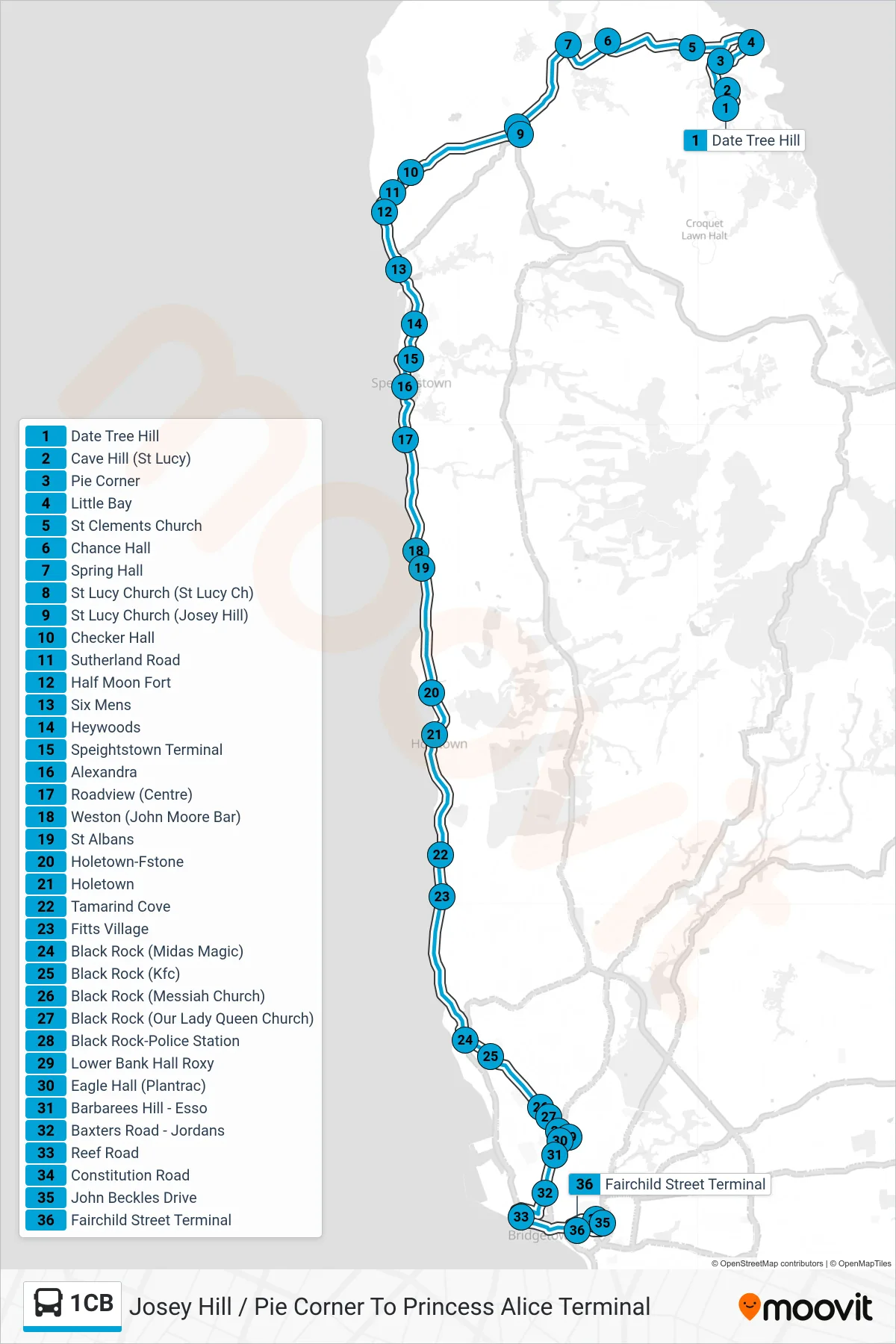
Stops list (1CB - Josey Hill / Pie Corner To Princess Alice Terminal)
- Date Tree Hill
- Cave Hill (St Lucy)
- Pie Corner
- Little Bay
- St Clements Church
- Chance Hall
- Spring Hall
- St Lucy Church (St Lucy Ch)
- St Lucy Church (Josey Hill)
- Checker Hall
- Sutherland Road
- Half Moon Fort
- Six Mens
- Heywoods
- Speightstown Terminal
- Alexandra
- Roadview (Centre)
- Weston (John Moore Bar)
- St Albans
- Holetown-Fstone
- Holetown
- Tamarind Cove
- Fitts Village
- Black Rock (Midas Magic)
- Black Rock (Kfc)
- Black Rock (Messiah Church)
- Black Rock (Our Lady Queen Church)
- Black Rock-Police Station
- Lower Bank Hall Roxy
- Eagle Hall (Plantrac)
- Barbarees Hill - Esso
- Baxters Road - Jordans
- Reef Road
- Constitution Road
- John Beckles Drive
- Fairchild Street Terminal