
1H Bus Route Map
View the 1H route map and see all 1H stops along the route. The map of 1H shows where the bus travels and the location of each stop, making it easy to understand the entire route at a glance.
Explore Transport Board routes on the map and see where Transport Board bus services operate. Use the 1H map to find bus stops and see how the 1H connects different areas along its trip.
All 1H stops on the map are displayed in route order, helping you follow the 1H bus from the first stop to the last.
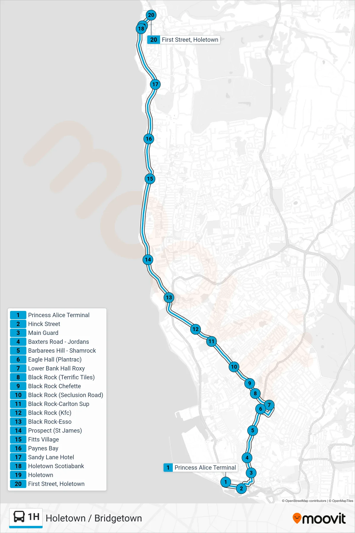
Stops list (1H - Princess Alice Terminal To Holetown)
- Princess Alice Terminal
- Hinck Street
- Main Guard
- Baxters Road - Jordans
- Barbarees Hill - Shamrock
- Eagle Hall (Plantrac)
- Lower Bank Hall Roxy
- Black Rock (Terrific Tiles)
- Black Rock Chefette
- Black Rock (Seclusion Road)
- Black Rock-Carlton Sup
- Black Rock (Kfc)
- Black Rock-Esso
- Prospect (St James)
- Fitts Village
- Paynes Bay
- Sandy Lane Hotel
- Holetown Scotiabank
- Holetown
- First Street, Holetown