
2 Bus Route Map
View the 2 route map and see all 2 stops along the route. The map of 2 shows where the bus travels and the location of each stop, making it easy to understand the entire route at a glance.
Explore Athens Clarke County Transit routes on the map and see where Athens Clarke County Transit bus services operate. Use the 2 map to find bus stops and see how the 2 connects different areas along its trip.
All 2 stops on the map are displayed in route order, helping you follow the 2 bus from the first stop to the last.
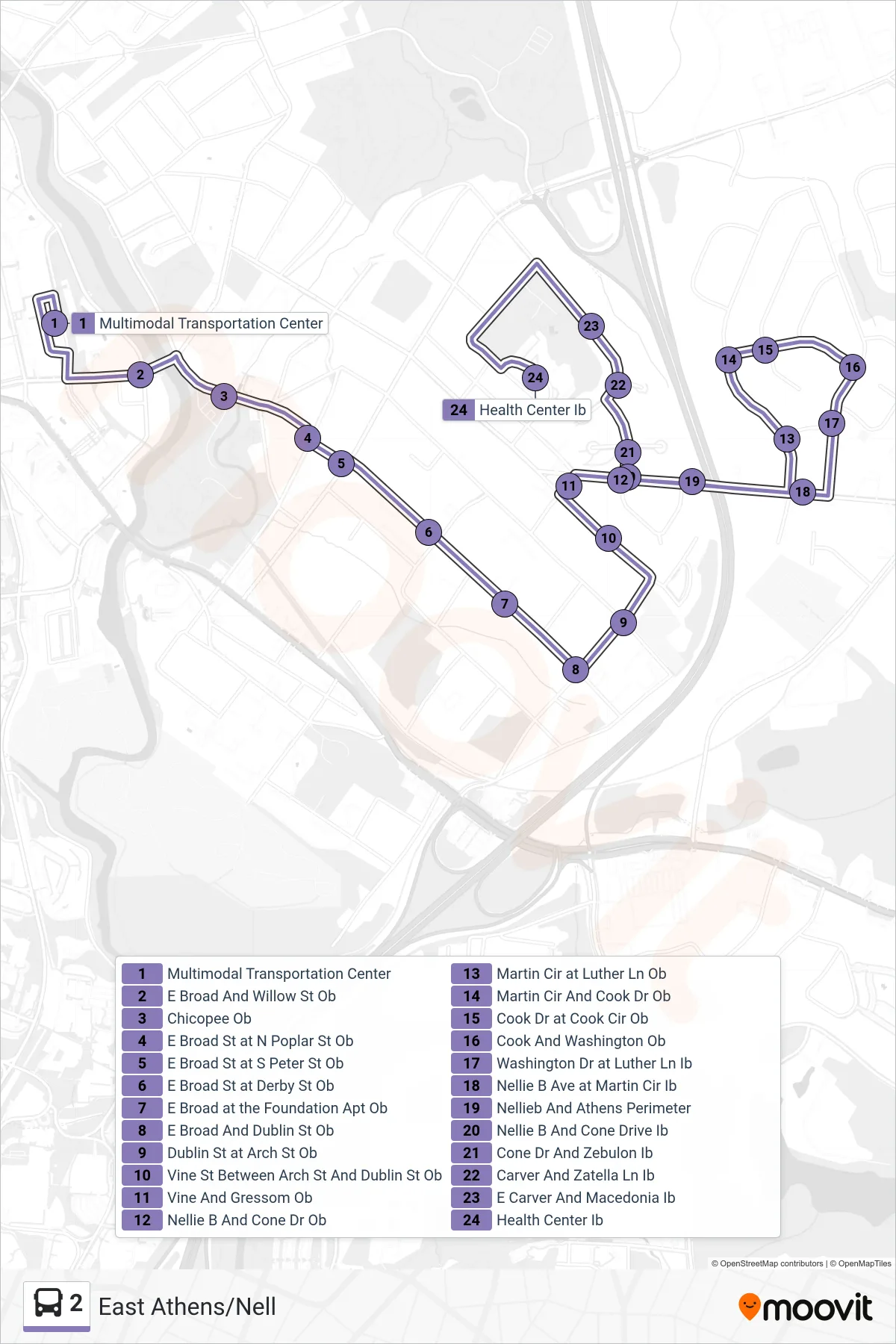
Stops list (2 - East Athens/Nell)
- Multimodal Transportation Center
- E Broad And Willow St Ob
- Chicopee Ob
- E Broad St at N Poplar St Ob
- E Broad St at S Peter St Ob
- E Broad St at Derby St Ob
- E Broad at the Foundation Apt Ob
- E Broad And Dublin St Ob
- Dublin St at Arch St Ob
- Vine St Between Arch St And Dublin St Ob
- Vine And Gressom Ob
- Nellie B And Cone Dr Ob
- Martin Cir at Luther Ln Ob
- Martin Cir And Cook Dr Ob
- Cook Dr at Cook Cir Ob
- Cook And Washington Ob
- Washington Dr at Luther Ln Ib
- Nellie B Ave at Martin Cir Ib
- Nellieb And Athens Perimeter
- Nellie B And Cone Drive Ib
- Cone Dr And Zebulon Ib
- Carver And Zatella Ln Ib
- E Carver And Macedonia Ib
- Health Center Ib