
2 Bus Route Map
View the 2 route map and see all 2 stops along the route. The map of 2 shows where the bus travels and the location of each stop, making it easy to understand the entire route at a glance.
Explore De Lijn routes on the map and see where De Lijn bus services operate. Use the 2 map to find bus stops and see how the 2 connects different areas along its trip.
All 2 stops on the map are displayed in route order, helping you follow the 2 bus from the first stop to the last.
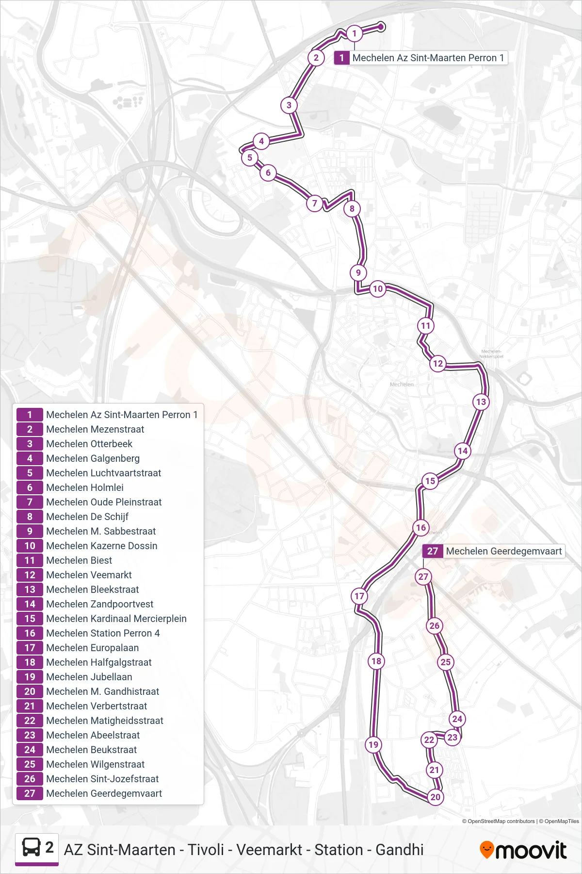
Stops list (2 - Mechelen Geerdegemvaart)
- Mechelen St. Maarten Hospital Platform 1
- Mechelen Tit Street
- Mechelen Otterbeek
- Mechelen Gallows Hill
- Mechelen Aviation Street
- Mechelen Holmlei
- Mechelen Old Plain Street
- Mechelen The Disc
- Mechelen M. Sabbe Street
- Mechelen Dossin Barracks
- Mechelen Biest
- Mechelen Cattle Market
- Mechelen Bleek Street
- Mechelen Sand Gate Fortress
- Mechelen Cardinal Mercier Square
- Mechelen Station Platform 4
- Mechelen Europa Avenue
- Mechelen Halfgalgstraat
- Mechelen Jubilee Avenue
- Mechelen M. Gandhi Street
- Mechelen Verbert Street
- Mechelen Temperance Street
- Mechelen Abeelstraat
- Mechelen Beech Street
- Mechelen Wilgen Street
- Mechelen Saint Joseph Street
- Mechelen Geerdegemvaart