
2 Bus Route Map
View the 2 route map and see all 2 stops along the route. The map of 2 shows where the bus travels and the location of each stop, making it easy to understand the entire route at a glance.
Explore Cascades East Transit routes on the map and see where Cascades East Transit bus services operate. Use the 2 map to find bus stops and see how the 2 connects different areas along its trip.
All 2 stops on the map are displayed in route order, helping you follow the 2 bus from the first stop to the last.
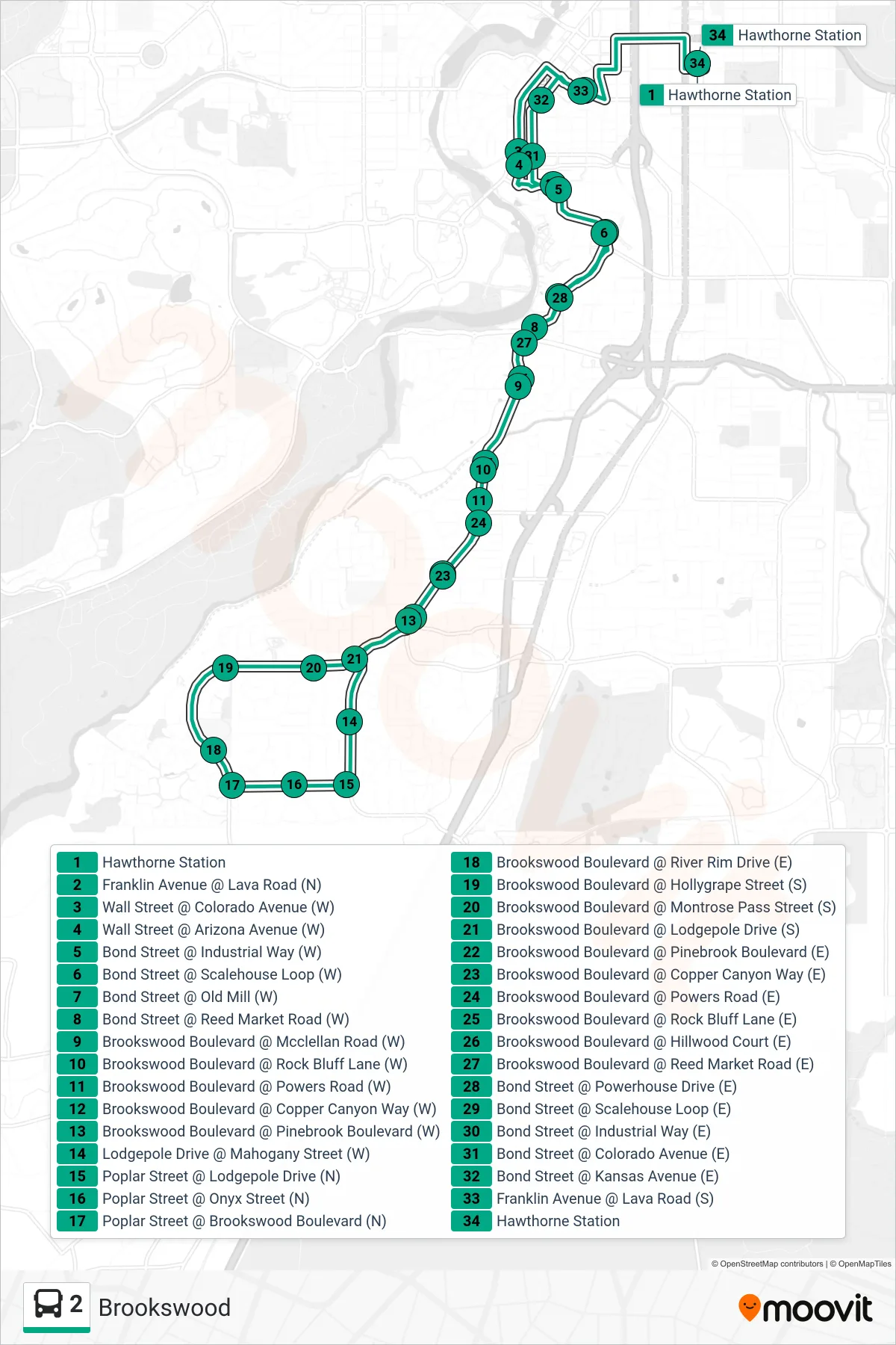
Stops list (2 - Platform C @ Hawthorne Station)
- Hawthorne Station
- Franklin Avenue @ Lava Road (N)
- Wall Street @ Colorado Avenue (W)
- Wall Street @ Arizona Avenue (W)
- Bond Street @ Industrial Way (W)
- Bond Street @ Scalehouse Loop (W)
- Bond Street @ Old Mill (W)
- Bond Street @ Reed Market Road (W)
- Brookswood Boulevard @ Mcclellan Road (W)
- Brookswood Boulevard @ Rock Bluff Lane (W)
- Brookswood Boulevard @ Powers Road (W)
- Brookswood Boulevard @ Copper Canyon Way (W)
- Brookswood Boulevard @ Pinebrook Boulevard (W)
- Lodgepole Drive @ Mahogany Street (W)
- Poplar Street @ Lodgepole Drive (N)
- Poplar Street @ Onyx Street (N)
- Poplar Street @ Brookswood Boulevard (N)
- Brookswood Boulevard @ River Rim Drive (E)
- Brookswood Boulevard @ Hollygrape Street (S)
- Brookswood Boulevard @ Montrose Pass Street (S)
- Brookswood Boulevard @ Lodgepole Drive (S)
- Brookswood Boulevard @ Pinebrook Boulevard (E)
- Brookswood Boulevard @ Copper Canyon Way (E)
- Brookswood Boulevard @ Powers Road (E)
- Brookswood Boulevard @ Rock Bluff Lane (E)
- Brookswood Boulevard @ Hillwood Court (E)
- Brookswood Boulevard @ Reed Market Road (E)
- Bond Street @ Powerhouse Drive (E)
- Bond Street @ Scalehouse Loop (E)
- Bond Street @ Industrial Way (E)
- Bond Street @ Colorado Avenue (E)
- Bond Street @ Kansas Avenue (E)
- Franklin Avenue @ Lava Road (S)
- Hawthorne Station