
2 Bus Route Map
View the 2 route map and see all 2 stops along the route. The map of 2 shows where the bus travels and the location of each stop, making it easy to understand the entire route at a glance.
Explore WRTA routes on the map and see where WRTA bus services operate. Use the 2 map to find bus stops and see how the 2 connects different areas along its trip.
All 2 stops on the map are displayed in route order, helping you follow the 2 bus from the first stop to the last.
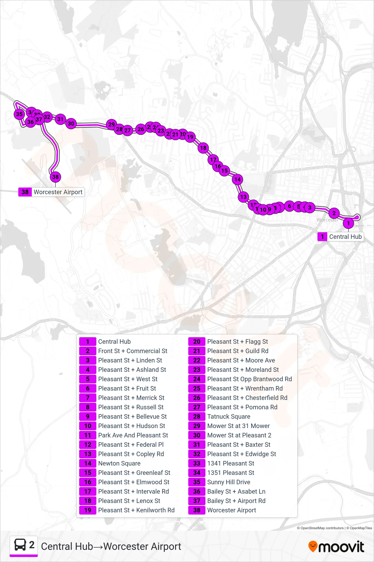
Stops list (2 - Central Hub→Worcester Airport)
- Central Hub
- Front St + Commercial St
- Pleasant St + Linden St
- Pleasant St + Ashland St
- Pleasant St + West St
- Pleasant St + Fruit St
- Pleasant St + Merrick St
- Pleasant St + Russell St
- Pleasant St + Bellevue St
- Pleasant St + Hudson St
- Park Ave And Pleasant St
- Pleasant St + Federal Pl
- Pleasant St + Copley Rd
- Newton Square
- Pleasant St + Greenleaf St
- Pleasant St + Elmwood St
- Pleasant St + Intervale Rd
- Pleasant St + Lenox St
- Pleasant St + Kenilworth Rd
- Pleasant St + Flagg St
- Pleasant St + Guild Rd
- Pleasant St + Moore Ave
- Pleasant St + Moreland St
- Pleasant St Opp Brantwood Rd
- Pleasant St + Wrentham Rd
- Pleasant St + Chesterfield Rd
- Pleasant St + Pomona Rd
- Tatnuck Square
- Mower St at 31 Mower
- Mower St at Pleasant 2
- Pleasant St + Baxter St
- Pleasant St + Edwidge St
- 1341 Pleasant St
- 1351 Pleasant St
- Sunny Hill Drive
- Bailey St + Asabet Ln
- Bailey St + Airport Rd
- Worcester Airport