
2 Bus Route Map
View the 2 route map and see all 2 stops along the route. The map of 2 shows where the bus travels and the location of each stop, making it easy to understand the entire route at a glance.
Explore Space Coast Area Transit routes on the map and see where Space Coast Area Transit bus services operate. Use the 2 map to find bus stops and see how the 2 connects different areas along its trip.
All 2 stops on the map are displayed in route order, helping you follow the 2 bus from the first stop to the last.
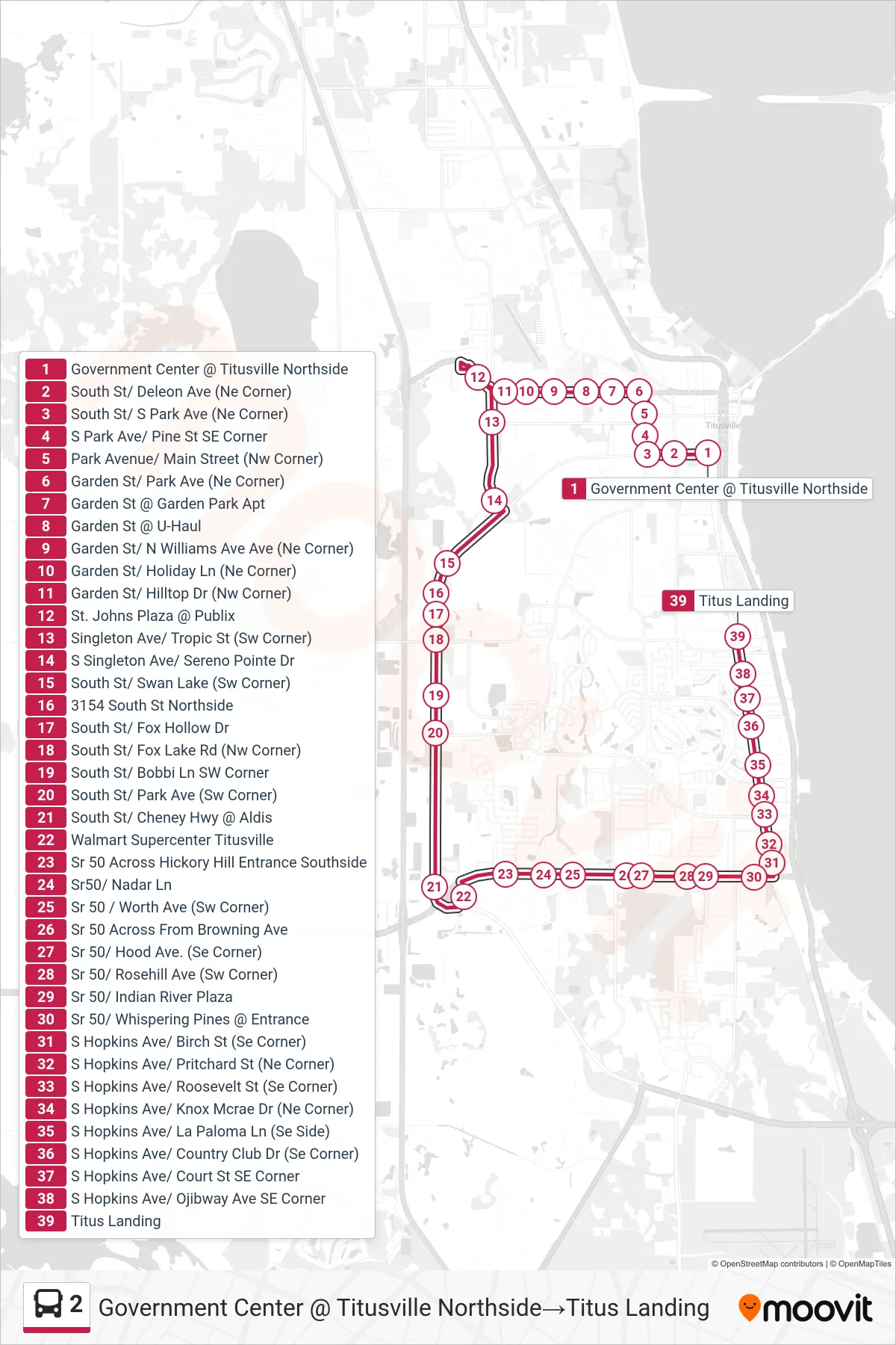
Stops list (2 - Government Center @ Titusville Northside→Titus Landing)
- Government Center @ Titusville Northside
- South St/ Deleon Ave (Ne Corner)
- South St/ S Park Ave (Ne Corner)
- S Park Ave/ Pine St SE Corner
- Park Avenue/ Main Street (Nw Corner)
- Garden St/ Park Ave (Ne Corner)
- Garden St @ Garden Park Apt
- Garden St @ U-Haul
- Garden St/ N Williams Ave Ave (Ne Corner)
- Garden St/ Holiday Ln (Ne Corner)
- Garden St/ Hilltop Dr (Nw Corner)
- St. Johns Plaza @ Publix
- Singleton Ave/ Tropic St (Sw Corner)
- S Singleton Ave/ Sereno Pointe Dr
- South St/ Swan Lake (Sw Corner)
- 3154 South St Northside
- South St/ Fox Hollow Dr
- South St/ Fox Lake Rd (Nw Corner)
- South St/ Bobbi Ln SW Corner
- South St/ Park Ave (Sw Corner)
- South St/ Cheney Hwy @ Aldis
- Walmart Supercenter Titusville
- Sr 50 Across Hickory Hill Entrance Southside
- Sr50/ Nadar Ln
- Sr 50 / Worth Ave (Sw Corner)
- Sr 50 Across From Browning Ave
- Sr 50/ Hood Ave. (Se Corner)
- Sr 50/ Rosehill Ave (Sw Corner)
- Sr 50/ Indian River Plaza
- Sr 50/ Whispering Pines @ Entrance
- S Hopkins Ave/ Birch St (Se Corner)
- S Hopkins Ave/ Pritchard St (Ne Corner)
- S Hopkins Ave/ Roosevelt St (Se Corner)
- S Hopkins Ave/ Knox Mcrae Dr (Ne Corner)
- S Hopkins Ave/ La Paloma Ln (Se Side)
- S Hopkins Ave/ Country Club Dr (Se Corner)
- S Hopkins Ave/ Court St SE Corner
- S Hopkins Ave/ Ojibway Ave SE Corner
- Titus Landing