
2 Bus Route Map
View the 2 route map and see all 2 stops along the route. The map of 2 shows where the bus travels and the location of each stop, making it easy to understand the entire route at a glance.
Explore NT routes on the map and see where NT bus services operate. Use the 2 map to find bus stops and see how the 2 connects different areas along its trip.
All 2 stops on the map are displayed in route order, helping you follow the 2 bus from the first stop to the last.
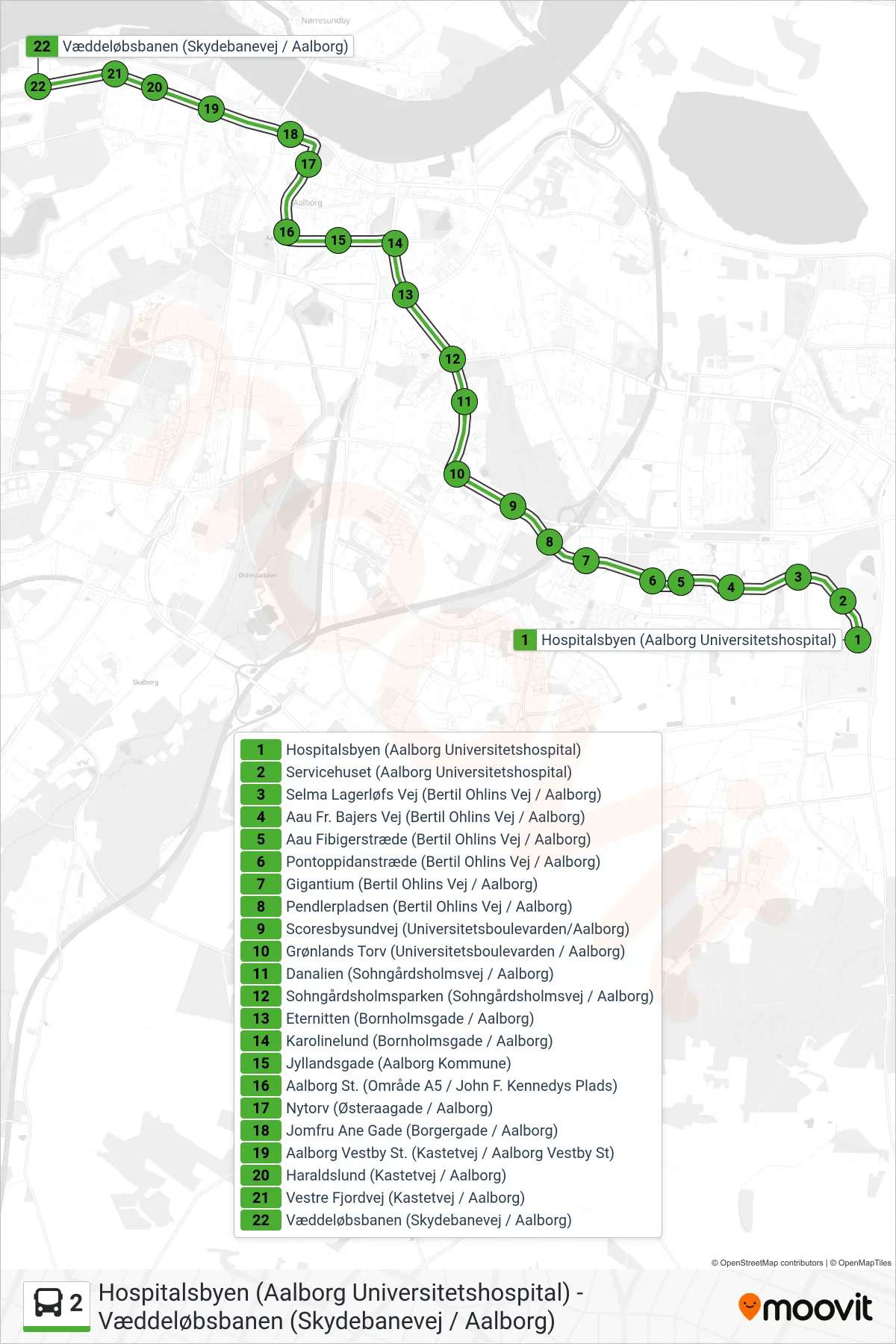
Stops list (2 - Væddeløbsbanen)
- Hospitalsbyen (Aalborg Universitetshospital)
- Servicehuset (Aalborg Universitetshospital)
- Selma Lagerløfs Vej (Bertil Ohlins Vej / Aalborg)
- Aau Fr. Bajers Vej (Bertil Ohlins Vej / Aalborg)
- Aau Fibigerstræde (Bertil Ohlins Vej / Aalborg)
- Pontoppidanstræde (Bertil Ohlins Vej / Aalborg)
- Gigantium (Bertil Ohlins Vej / Aalborg)
- Pendlerpladsen (Bertil Ohlins Vej / Aalborg)
- Scoresbysundvej (Universitetsboulevarden/Aalborg)
- Grønlands Torv (Universitetsboulevarden / Aalborg)
- Danalien (Sohngårdsholmsvej / Aalborg)
- Sohngårdsholmsparken (Sohngårdsholmsvej / Aalborg)
- Eternitten (Bornholmsgade / Aalborg)
- Karolinelund (Bornholmsgade / Aalborg)
- Jyllandsgade (Aalborg Kommune)
- Aalborg St. (Område A5 / John F. Kennedys Plads)
- Nytorv (Østeraagade / Aalborg)
- Jomfru Ane Gade (Borgergade / Aalborg)
- Aalborg Vestby St. (Kastetvej / Aalborg Vestby St)
- Haraldslund (Kastetvej / Aalborg)
- Vestre Fjordvej (Kastetvej / Aalborg)
- Væddeløbsbanen (Skydebanevej / Aalborg)