
2 Bus Route Map
View the 2 route map and see all 2 stops along the route. The map of 2 shows where the bus travels and the location of each stop, making it easy to understand the entire route at a glance.
Explore NT routes on the map and see where NT bus services operate. Use the 2 map to find bus stops and see how the 2 connects different areas along its trip.
All 2 stops on the map are displayed in route order, helping you follow the 2 bus from the first stop to the last.
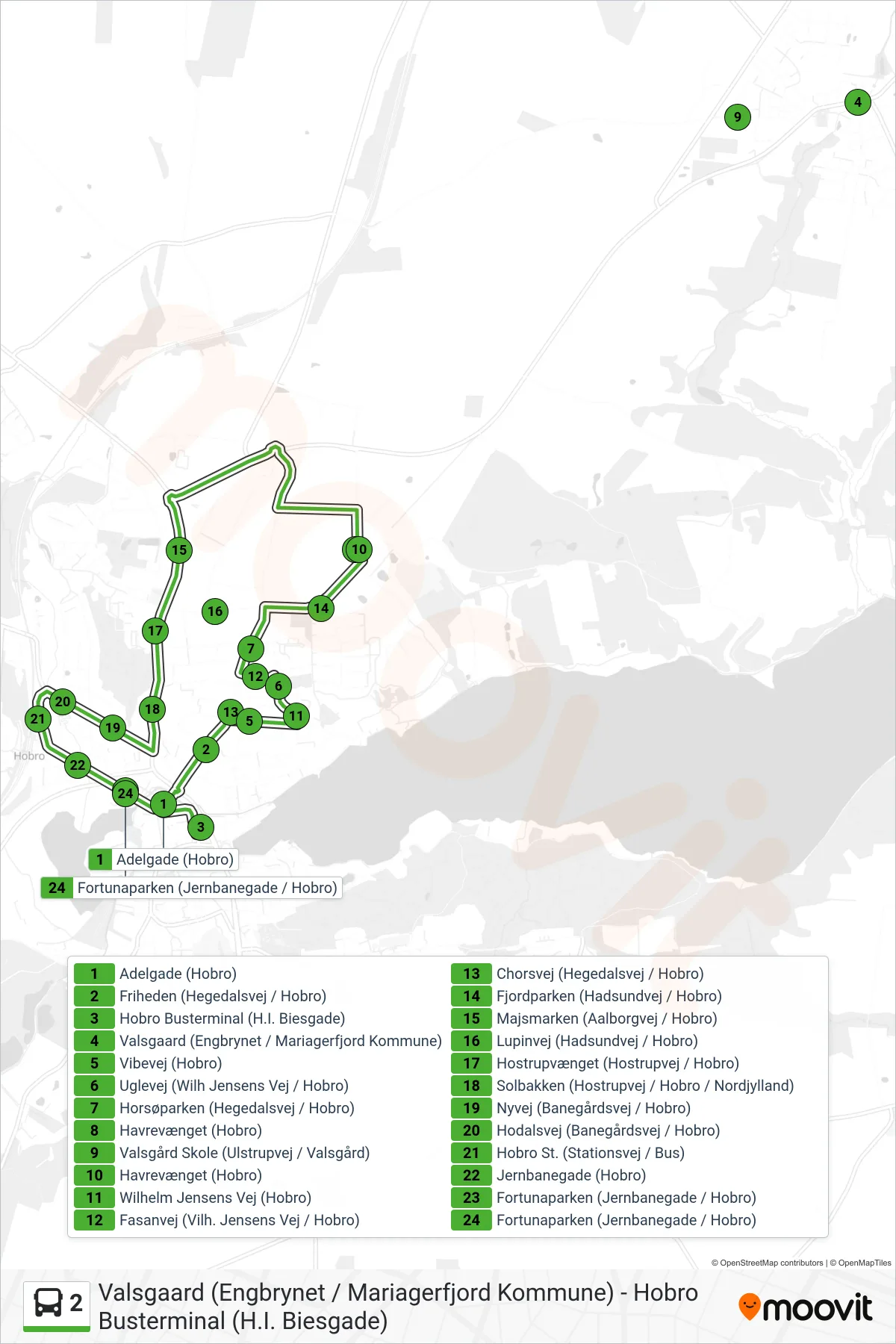
Stops list (2 - Hobro Busterminal (H.I. Biesgade))
- Adelgade (Hobro)
- Friheden (Hegedalsvej / Hobro)
- Hobro Busterminal (H.I. Biesgade)
- Valsgaard (Engbrynet / Mariagerfjord Kommune)
- Vibevej (Hobro)
- Uglevej (Wilh Jensens Vej / Hobro)
- Horsøparken (Hegedalsvej / Hobro)
- Havrevænget (Hobro)
- Valsgård Skole (Ulstrupvej / Valsgård)
- Havrevænget (Hobro)
- Wilhelm Jensens Vej (Hobro)
- Fasanvej (Vilh. Jensens Vej / Hobro)
- Chorsvej (Hegedalsvej / Hobro)
- Fjordparken (Hadsundvej / Hobro)
- Majsmarken (Aalborgvej / Hobro)
- Lupinvej (Hadsundvej / Hobro)
- Hostrupvænget (Hostrupvej / Hobro)
- Solbakken (Hostrupvej / Hobro / Nordjylland)
- Nyvej (Banegårdsvej / Hobro)
- Hodalsvej (Banegårdsvej / Hobro)
- Hobro St. (Stationsvej / Bus)
- Jernbanegade (Hobro)
- Fortunaparken (Jernbanegade / Hobro)
- Fortunaparken (Jernbanegade / Hobro)