
2 Bus Route Map
View the 2 route map and see all 2 stops along the route. The map of 2 shows where the bus travels and the location of each stop, making it easy to understand the entire route at a glance.
Explore Midttrafik routes on the map and see where Midttrafik bus services operate. Use the 2 map to find bus stops and see how the 2 connects different areas along its trip.
All 2 stops on the map are displayed in route order, helping you follow the 2 bus from the first stop to the last.
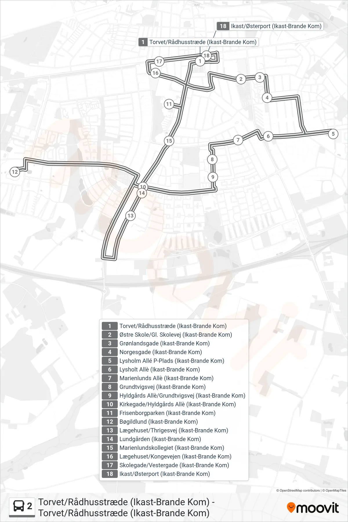
Stops list (2 - Torvet/Rådhusstræde (Ikast-Brande Kom))
- Torvet/Rådhusstræde (Ikast-Brande Kom)
- Østre Skole/Gl. Skolevej (Ikast-Brande Kom)
- Grønlandsgade (Ikast-Brande Kom)
- Norgesgade (Ikast-Brande Kom)
- Lysholm Allé P-Plads (Ikast-Brande Kom)
- Lysholt Allè (Ikast-Brande Kom)
- Marienlunds Allè (Ikast-Brande Kom)
- Grundtvigsvej (Ikast-Brande Kom)
- Hyldgårds Allè/Grundtvigsvej (Ikast-Brande Kom)
- Kirkegade/Hyldgårds Allè (Ikast-Brande Kom)
- Frisenborgparken (Ikast-Brande Kom)
- Bøgildlund (Ikast-Brande Kom)
- Lægehuset/Thrigesvej (Ikast-Brande Kom)
- Lundgården (Ikast-Brande Kom)
- Marienlundskollegiet (Ikast-Brande Kom)
- Lægehuset/Kongevejen (Ikast-Brande Kom)
- Skolegade/Vestergade (Ikast-Brande Kom)
- Ikast/Østerport (Ikast-Brande Kom)