
2 Bus Route Map
View the 2 route map and see all 2 stops along the route. The map of 2 shows where the bus travels and the location of each stop, making it easy to understand the entire route at a glance.
Explore Sydtrafik routes on the map and see where Sydtrafik bus services operate. Use the 2 map to find bus stops and see how the 2 connects different areas along its trip.
All 2 stops on the map are displayed in route order, helping you follow the 2 bus from the first stop to the last.
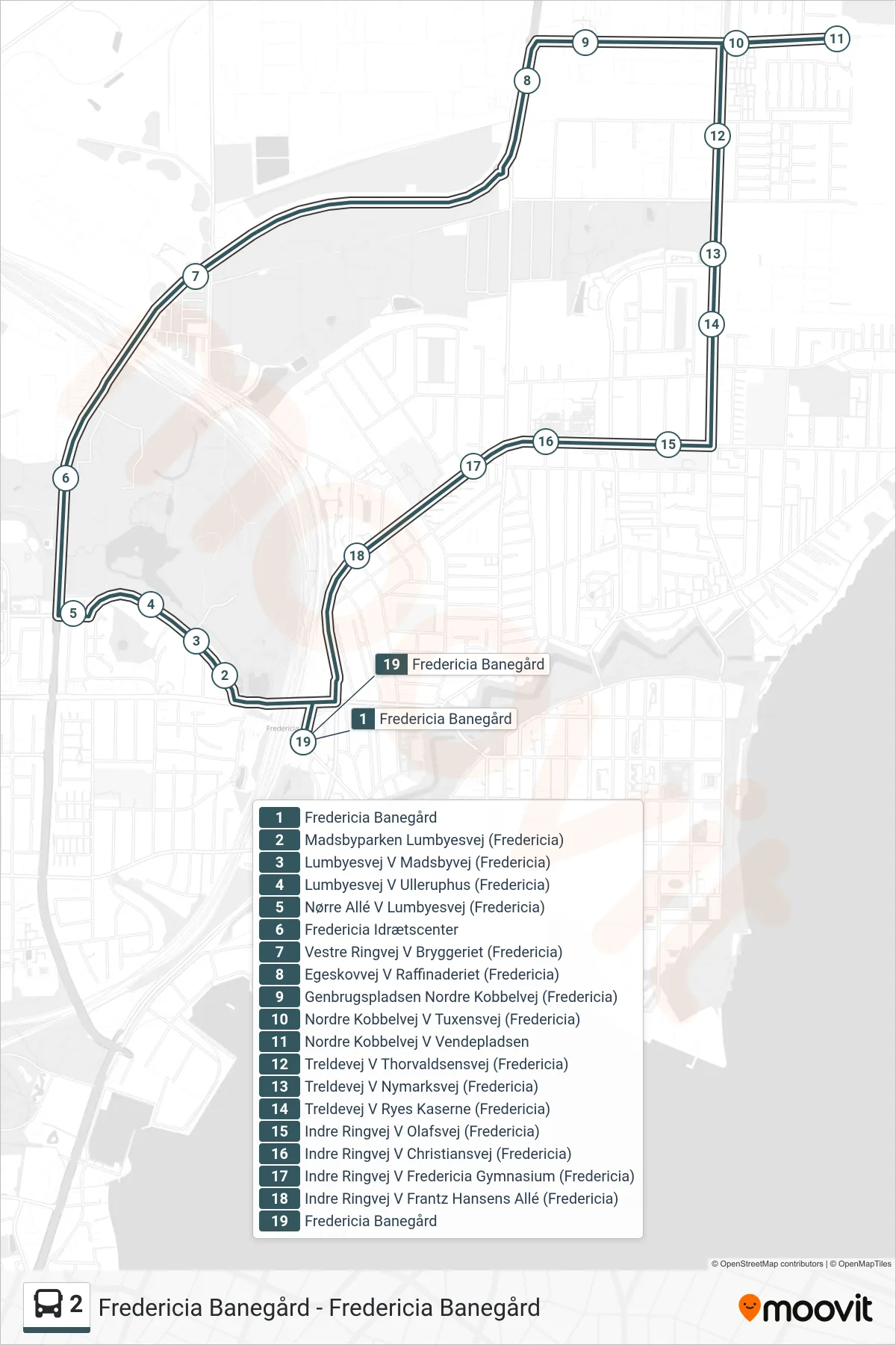
Stops list (2 - Fredericia Banegård)
- Fredericia Banegård
- Madsbyparken Lumbyesvej (Fredericia)
- Lumbyesvej V Madsbyvej (Fredericia)
- Lumbyesvej V Ulleruphus (Fredericia)
- Nørre Allé V Lumbyesvej (Fredericia)
- Fredericia Idrætscenter
- Vestre Ringvej V Bryggeriet (Fredericia)
- Egeskovvej V Raffinaderiet (Fredericia)
- Genbrugspladsen Nordre Kobbelvej (Fredericia)
- Nordre Kobbelvej V Tuxensvej (Fredericia)
- Nordre Kobbelvej V Vendepladsen
- Treldevej V Thorvaldsensvej (Fredericia)
- Treldevej V Nymarksvej (Fredericia)
- Treldevej V Ryes Kaserne (Fredericia)
- Indre Ringvej V Olafsvej (Fredericia)
- Indre Ringvej V Christiansvej (Fredericia)
- Indre Ringvej V Fredericia Gymnasium (Fredericia)
- Indre Ringvej V Frantz Hansens Allé (Fredericia)
- Fredericia Banegård