
2 Bus Route Map
View the 2 route map and see all 2 stops along the route. The map of 2 shows where the bus travels and the location of each stop, making it easy to understand the entire route at a glance.
Explore Prato and Province - Tuscan Bus Lines routes on the map and see where Prato and Province - Tuscan Bus Lines bus services operate. Use the 2 map to find bus stops and see how the 2 connects different areas along its trip.
All 2 stops on the map are displayed in route order, helping you follow the 2 bus from the first stop to the last.
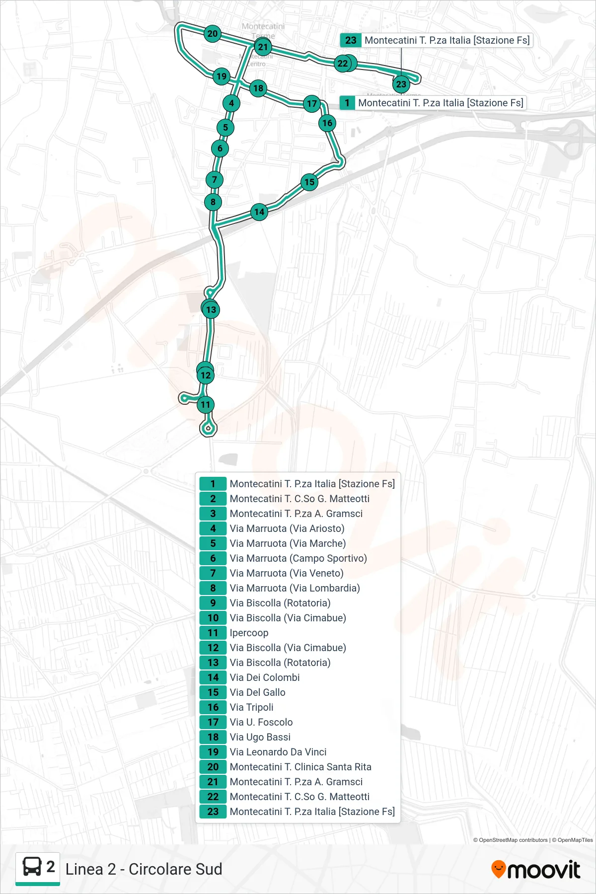
Stops list (2 - Montecatini P.za Italia [Stazione])
- Montecatini T. Italia Square [Railway Station]
- Montecatini Terme G. Matteotti Course
- Montecatini Terme Gramsci Square
- Via Marruota (Via Ariosto)
- Via Marruota (Via Marche)
- Via Marruota (Sports Field)
- Via Marruota (Via Veneto)
- Via Marruota (Lombardy Street)
- Via Biscolla (Roundabout)
- Via Biscolla (Cimabue Road)
- Ipercoop
- Via Biscolla (Cimabue Road)
- Via Biscolla (Roundabout)
- Dei Colombi Street
- Gallo Street
- Tripoli Street
- U. Foscolo Street
- Ugo Bassi Street
- Leonardo Da Vinci Street
- Montecatini Terme Santa Rita Clinic
- Montecatini Terme Gramsci Square
- Montecatini Terme G. Matteotti Course
- Montecatini T. Italia Square [Railway Station]