
2 Bus Route Map
View the 2 route map and see all 2 stops along the route. The map of 2 shows where the bus travels and the location of each stop, making it easy to understand the entire route at a glance.
Explore Bus Éireann routes on the map and see where Bus Éireann bus services operate. Use the 2 map to find bus stops and see how the 2 connects different areas along its trip.
All 2 stops on the map are displayed in route order, helping you follow the 2 bus from the first stop to the last.
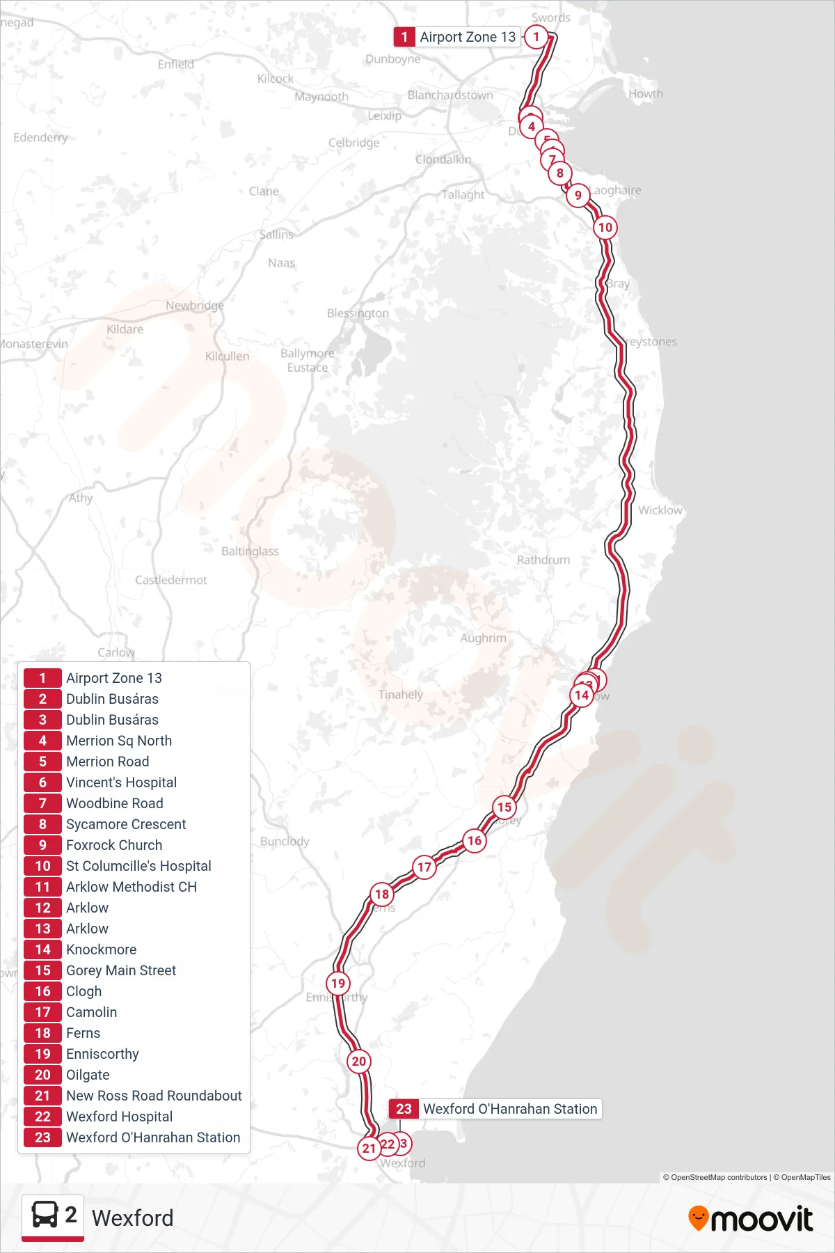
Stops list (2 - Wexford)
- Airport Zone 13
- Dublin Busáras
- Dublin Busáras
- Merrion Sq North
- Merrion Road
- Vincent's Hospital
- Woodbine Road
- Sycamore Crescent
- Foxrock Church
- St Columcille's Hospital
- Arklow Methodist CH
- Arklow
- Arklow
- Knockmore
- Gorey Main Street
- Clogh
- Camolin
- Ferns
- Enniscorthy
- Oilgate
- New Ross Road Roundabout
- Wexford Hospital
- Wexford O'Hanrahan Station