
2 Bus Route Map
View the 2 route map and see all 2 stops along the route. The map of 2 shows where the bus travels and the location of each stop, making it easy to understand the entire route at a glance.
Explore Dan Badarom routes on the map and see where Dan Badarom bus services operate. Use the 2 map to find bus stops and see how the 2 connects different areas along its trip.
All 2 stops on the map are displayed in route order, helping you follow the 2 bus from the first stop to the last.
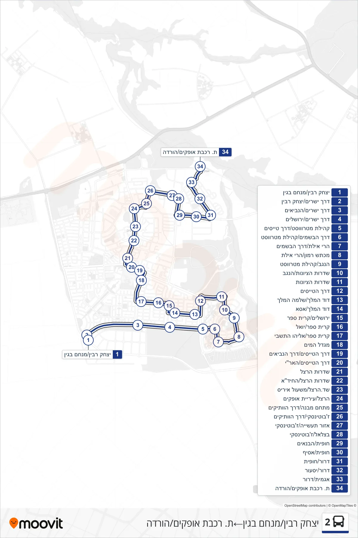
Stops list (2 - Yitzhak Rabin/Menachem Begin→Ofakim Railway Station/Drop Off)
- Yitzhak Rabin/Menachem Begin
- Derekh Yesharim/Yitzhak Rabin
- Derech Yesharim/HaNevi'im
- Derekh Yesharim/Jerusalem
- Metrowest Community/Pilots Road
- Derech HaBsamim/Metrowest Community
- Harei Eilat/Derech HaBsamim
- Makhtesh Ramon/Eilat Mountains
- HaNegev/Metrowest Community
- Zionism Boulevard/HaNegev
- HaTzionut Boulevard
- Pilots Road
- King David/King Solomon
- King David/Asa
- Jerusalem/Kiryat Sefer
- Kiryat Sefer/Yoel
- Kiryat Sefer/Eliyahu HaTishbi
- Water Tower
- Pilots Road/Prophets Road
- Pilots Road/HaAri
- Herzl Boulevard
- Herzl Boulevard/HaChida
- Sderot Herzl/Iris Path
- Herzl/Ofakim Municipality
- Complex Building/Veterans Way
- Jabotinsky/HaVatikim Road
- Industrial Zone/Jabotinsky
- Bezalel/Jabotinsky
- Hofit/HaBanaim
- Hofit/Asif
- Dror/Hofit
- Dror/Yasur
- Agamit/Dror
- Ofakim Railway Station/Drop Off