
2 Bus Route Map
View the 2 route map and see all 2 stops along the route. The map of 2 shows where the bus travels and the location of each stop, making it easy to understand the entire route at a glance.
Explore Urbanos de Coslada routes on the map and see where Urbanos de Coslada bus services operate. Use the 2 map to find bus stops and see how the 2 connects different areas along its trip.
All 2 stops on the map are displayed in route order, helping you follow the 2 bus from the first stop to the last.
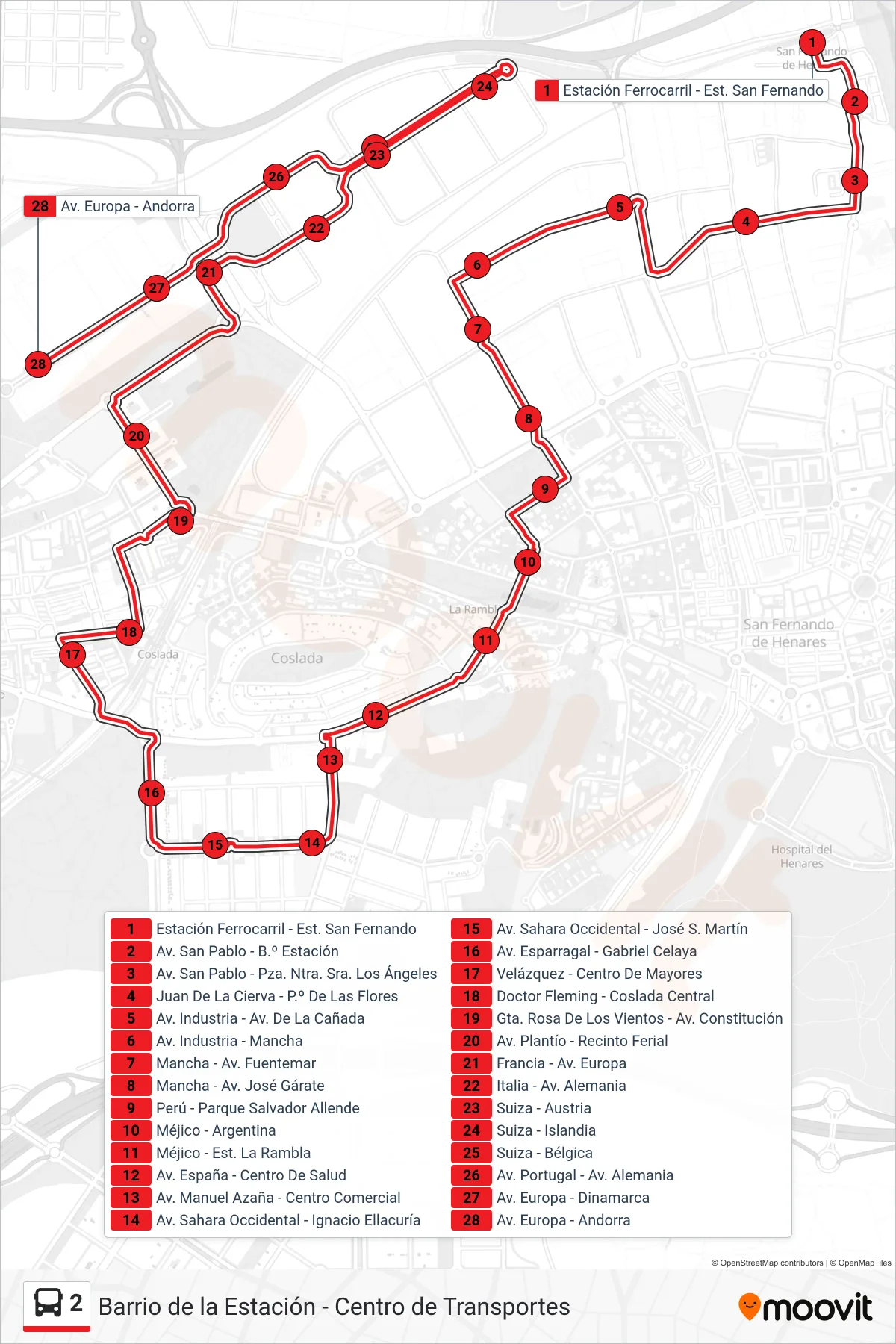
Stops list (2 - Centro de Transportes)
- Estación Ferrocarril - Est. San Fernando
- Av. San Pablo - B.º Estación
- Av. San Pablo - Pza. Ntra. Sra. Los Ángeles
- Juan De La Cierva - P.º De Las Flores
- Av. Industria - Av. De La Cañada
- Av. Industria - Mancha
- Mancha - Av. Fuentemar
- Mancha - Av. José Gárate
- Perú - Parque Salvador Allende
- Méjico - Argentina
- Méjico - Est. La Rambla
- Av. España - Centro De Salud
- Av. Manuel Azaña - Centro Comercial
- Av. Sahara Occidental - Ignacio Ellacuría
- Av. Sahara Occidental - José S. Martín
- Av. Esparragal - Gabriel Celaya
- Velázquez - Centro De Mayores
- Doctor Fleming - Coslada Central
- Gta. Rosa De Los Vientos - Av. Constitución
- Av. Plantío - Recinto Ferial
- Francia - Av. Europa
- Italia - Av. Alemania
- Suiza - Austria
- Suiza - Islandia
- Suiza - Bélgica
- Av. Portugal - Av. Alemania
- Av. Europa - Dinamarca
- Av. Europa - Andorra