
2 Bus Route Map
View the 2 route map and see all 2 stops along the route. The map of 2 shows where the bus travels and the location of each stop, making it easy to understand the entire route at a glance.
Explore Stadtwerke Trier routes on the map and see where Stadtwerke Trier bus services operate. Use the 2 map to find bus stops and see how the 2 connects different areas along its trip.
All 2 stops on the map are displayed in route order, helping you follow the 2 bus from the first stop to the last.
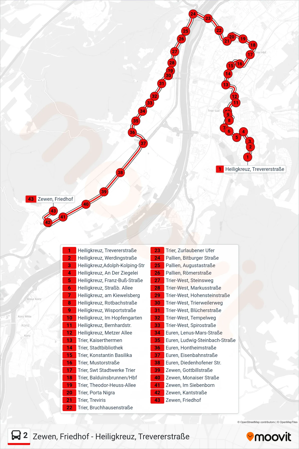
Stops list (2 - Zewen, Friedhof)
- Heiligkreuz, Trevererstraße
- Heiligkreuz, Werdingstraße
- Heiligkreuz,Adolph-Kolping-Str
- Heiligkreuz, An Der Ziegelei
- Heiligkreuz, Franz-Buß-Straße
- Heiligkreuz, Straßb. Allee
- Heiligkreuz, am Kiewelsberg
- Heiligkreuz, Rotbachstraße
- Heiligkreuz, Wisportstraße
- Heiligkreuz, Im Hopfengarten
- Heiligkreuz, Bernhardstr.
- Heiligkreuz, Metzer Allee
- Trier, Kaiserthermen
- Trier, Stadtbibliothek
- Trier, Konstantin Basilika
- Trier, Mustorstraße
- Trier, Swt Stadtwerke Trier
- Trier, Balduinsbrunnen/Hbf
- Trier, Theodor-Heuss-Allee
- Trier, Porta Nigra
- Trier, Treviris
- Trier, Bruchhausenstraße
- Trier, Zurlaubener Ufer
- Pallien, Bitburger Straße
- Pallien, Augustastraße
- Pallien, Römerstraße
- Trier-West, Steinsweg
- Trier-West, Markusstraße
- Trier-West, Hohensteinstraße
- Trier-West, Trierweilerweg
- Trier-West, Blücherstraße
- Trier-West, Tempelweg
- Trier-West, Spirostraße
- Euren, Lenus-Mars-Straße
- Euren, Ludwig-Steinbach-Straße
- Euren, Hontheimstraße
- Euren, Eisenbahnstraße
- Euren, Diedenhofener Str.
- Zewen, Gottbillstraße
- Zewen, Monaiser Straße
- Zewen, Im Siebenborn
- Zewen, Kantstraße
- Zewen, Friedhof